
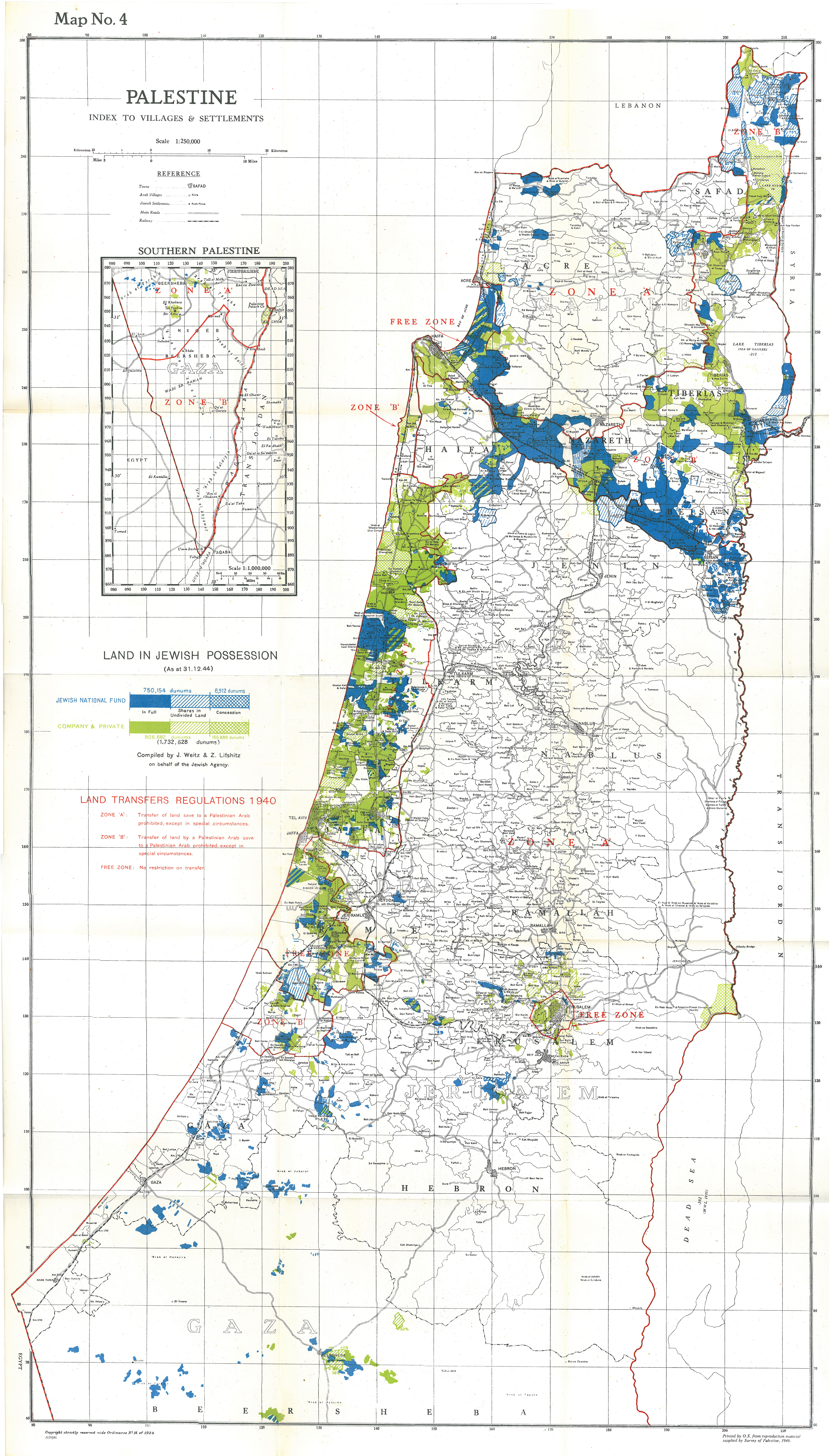
Image: Palestine Index to Villages and Settlements, showing Land in Jewish Possession as at 31.12.44
Size of this preview: 341 × 599 pixels. Other resolutions: 136 × 240 pixels | 4,000 × 7,022 pixels.
Original image (4,000 × 7,022 pixels, file size: 8.11 MB, MIME type: image/jpeg)
Description: Palestine Index to Villages and Settlements, showing Land in Jewish Possession as at 31.12.44
Title: Palestine Index to Villages and Settlements, showing Land in Jewish Possession as at 31.12.44
Credit: Maps relating to the Report of the Anglo-American Committee of Enquiry Regarding the Problems of European Jewry and Palestine
Author: w:Office of Public Sector Information
Usage Terms: Public domain
License: Public domain
Attribution Required?: No
Image usage
The following 2 pages link to this image:

All content from Kiddle encyclopedia articles (including the article images and facts) can be freely used under Attribution-ShareAlike license, unless stated otherwise.