
Image: Pangaea assembly 430
Size of this preview: 800 × 566 pixels. Other resolutions: 320 × 226 pixels | 1,123 × 794 pixels.
Original image (1,123 × 794 pixels, file size: 128 KB, MIME type: image/png)
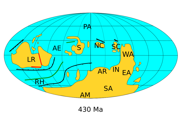
Description: This image depicts the positions of the continents 430 million years ago. LR = Larussia; S = Siberia; NC = North China; SC = South China; WA = West Australia; EA = East Antarctica; IN = India; AR = Arabia; SA = South Africa; AM = Amazonia; AE = Aegir Ocean; RH = Rheic Ocean; PA = Panthalassic Ocean. Orogenies shown in red. Subduction zones shown in black. Spreading centers shown in green. Based on Torsvik and Cocks (2017) Earth History and Paleogeography, ISBN 978-1-107-10532-4, p.87.
Usage Terms: Public domain
Image usage
The following page links to this image:

All content from Kiddle encyclopedia articles (including the article images and facts) can be freely used under Attribution-ShareAlike license, unless stated otherwise.