
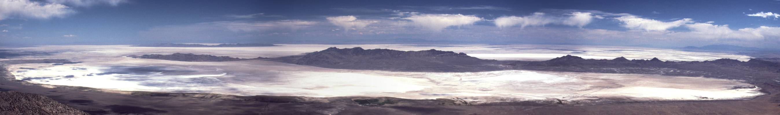
Image: Panorama of the Great Salt Lake Desert
Description: Panoramic view from Pilot Peak-(en:Pilot Range-Nevada border), looking from northeast (left) to south (right) into the Great Salt Lake Desert. In the near distance are the Silver Island Mountains-(across the en:Pilot Valley Playa, Utah), and at (extreme)-left, in the further distance, are the en:Hogup Mountains. The central, high Silver Island block, has the small subsection attached north (at photo left, Crater Island (a peak), 5743 ft). The view directly EAST over the sub-section, (on horizona), shows the arc-shaped Newfoundland Mountains-(15-miles long)). Pilot Peak, is 15 mi distance from the Silver Island Mountains.
Title: Panorama of the Great Salt Lake Desert
Credit: Transferred from en.wikipedia to Commons.
Author: G. Thomas at English Wikipedia
Usage Terms: Public domain
License: Public domain
Attribution Required?: No
Image usage
The following 2 pages link to this image:
