
Image: PedraBranca-MapofDominionsofJohore-Hamilton-1727
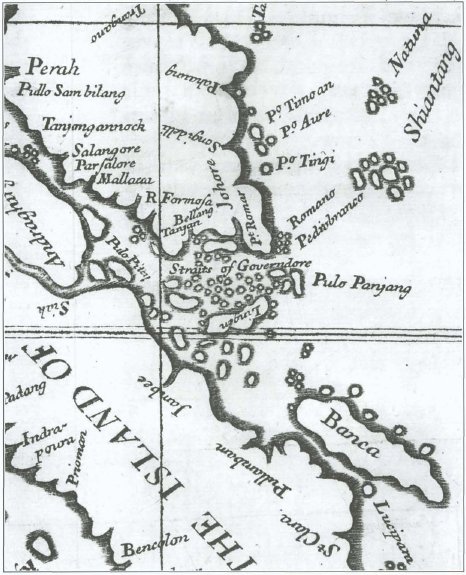
Description: Detail of Alexander Hamilton's "A Map of the Dominions of Johore and of the Island of Sumatra with the Adjacent Islands" showing the island of "Pedrobranco" (Pedra Branca): see Case Concerning Sovereignty over Pedra Branca/Pulau Batu Puteh, Middle Rocks and South Ledge (Malaysia/Singapore): Memorial of Malaysia, vol. 1, p. 137, para. 307.
Title: PedraBranca-MapofDominionsofJohore-Hamilton-1727
Credit: Alexander Hamilton (1727) A New Account of the East Indies, being the Observations and Remarks of Capt. Alexander Hamilton, who Spent His Time there from the Year 1688 to 1723, Trading and Travelling, by Sea and Land, to most of the Countries and Islands of Commerce and Navigation, between the Cape of Goodhope and the Island of Japon ..., Edinburgh: Printed by J. Mosman 2 vols. Reproduced as insert 24 of (25 March 2004) Case Concerning Sovereignty over Pedra Branca/Pulau Batu Puteh, Middle Rocks and South Ledge (Malaysia/Singapore): Memorial of Malaysia, volume 1, Government of Malaysia (reproduced on the International Court of Justice website), pp. 139 Retrieved on 28 September 2008.
Author: Unknown author; book by Alexander Hamilton.
Usage Terms: Public domain
License: Public domain
Attribution Required?: No
Image usage
The following page links to this image:
