
Image: Pend Oreille-Clark Fork dams
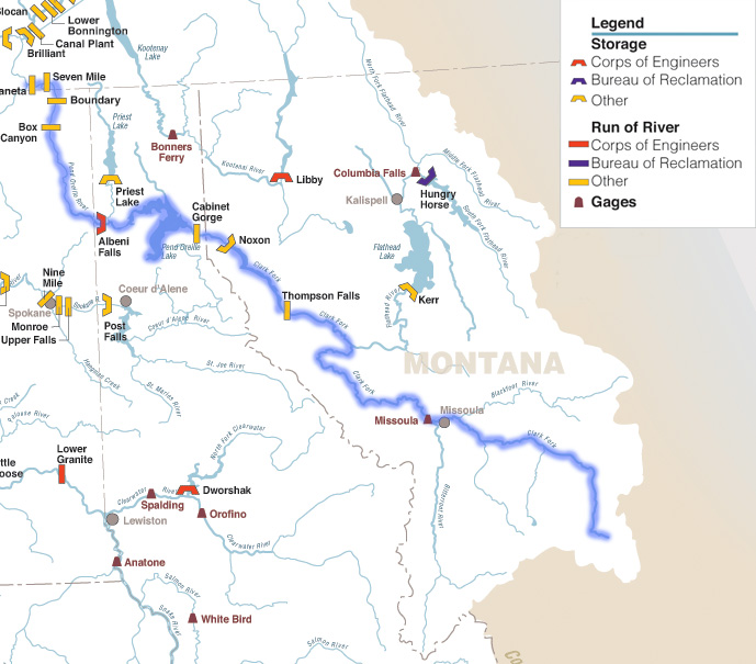
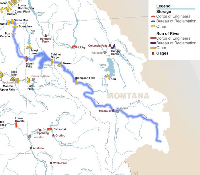
Description: Maps of the Pend Oreille River, its tributary the Clark Fork River, and dams on them — in Montana, Idaho, and Washington (state). The Pend Oreille River is a tributary of the Columbia River, and it and the Clark Fork River are within the Columbia River Basin. Original caption The Columbia River carved the Interior Columbia River Basin from the landscape of seven Western states and two Canadian provinces. The river itself flows from its headwaters in British Columbia, Canada through only two states, forming part of the Washington-Oregon border, the vast Interior Columbia River Basin is defined by the area drained by the river and its many tributaries. This 58-million-hectare area (about the size of France) extends roughly from the crest of the Cascade Mountains of Oregon and Washington east through Idaho to the Continental Divide in the Rocky Mountains of Montana and Wyoming, and from the headwaters of the Columbia River in Canada to the high desert of northern Nevada and northwestern Utah.
Title: Pend Oreille-Clark Fork dams
Credit: Pacific_Northwest_River_System.png
Author: Pacific_Northwest_River_System.png: U.S. Army Corps of Engineers derivative work: {{SUBST:Shannon1/sig}}
Usage Terms: Public domain
License: Public domain
Attribution Required?: No
Image usage
The following page links to this image:
