
Image: Picoduartemap
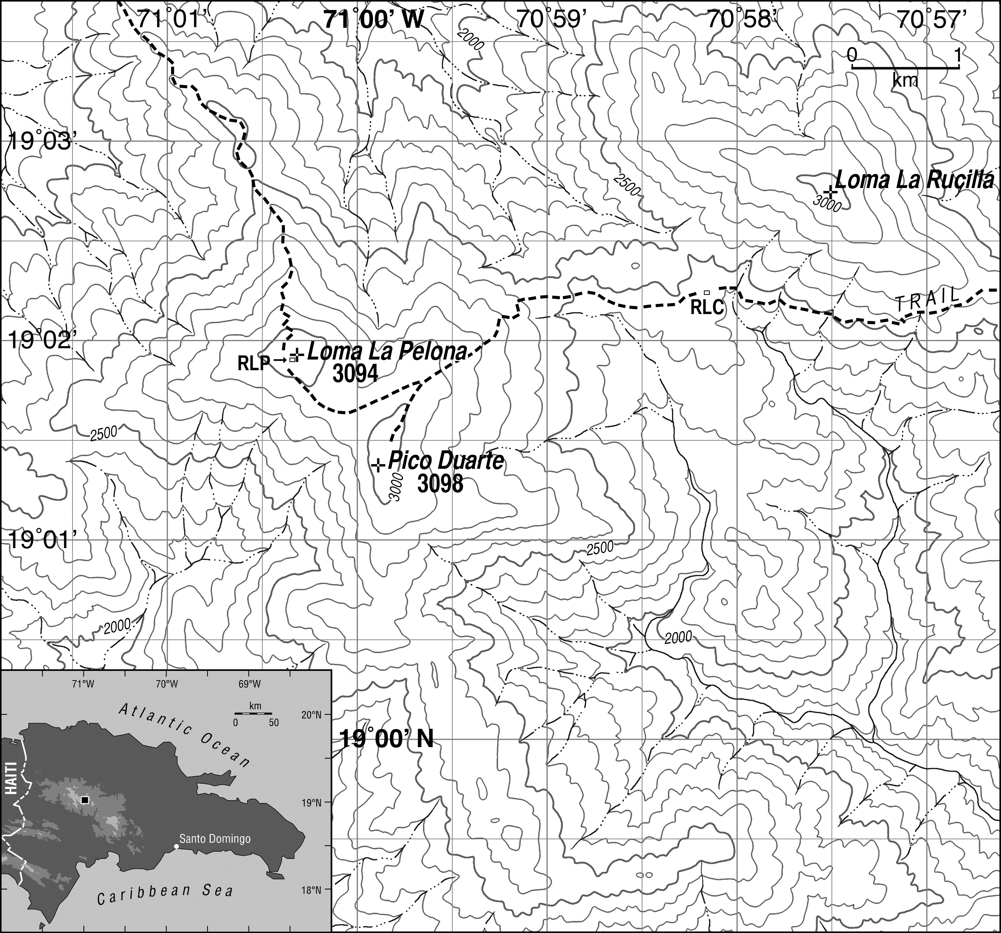
Description: Map general area surrounding Pico Duarte. Contour interval is 100 m. RLP: Refugio La Pelona. RLC: Refugio La Compartición. Inset shows Dominican Republic with location of main map highlighted. Datum is WGS 84; projection is Universal Transverse Mercator (19N). Trails and shelters were mapped using GPS and aerial photography; topography and streams were adjusted from the Lamedero (NW, 1969), Manabao (NE, 1969), Juan de Herrera (SW, 1969) and Gajo de Monte (SE, 1962) 1:50000 scale topographic quadrangles published by the U.S. Army Map Service and compiled by that group in collaboration with the Instituto Cartográfico Militar, the Instituto Cartográfico Universitario and the Inter-American Geodetic Survey.
Title: Picoduartemap
Credit: Kenneth H. Orvis
Author: Kenneth H. Orvis
Permission: Use is allowed if attribution of author is given
Usage Terms: Creative Commons Attribution 1.0
License: CC BY 1.0
License Link: https://creativecommons.org/licenses/by/1.0
Attribution Required?: Yes
Image usage
The following page links to this image:
