
Image: Pittsburgh Volume 3 Plate 1
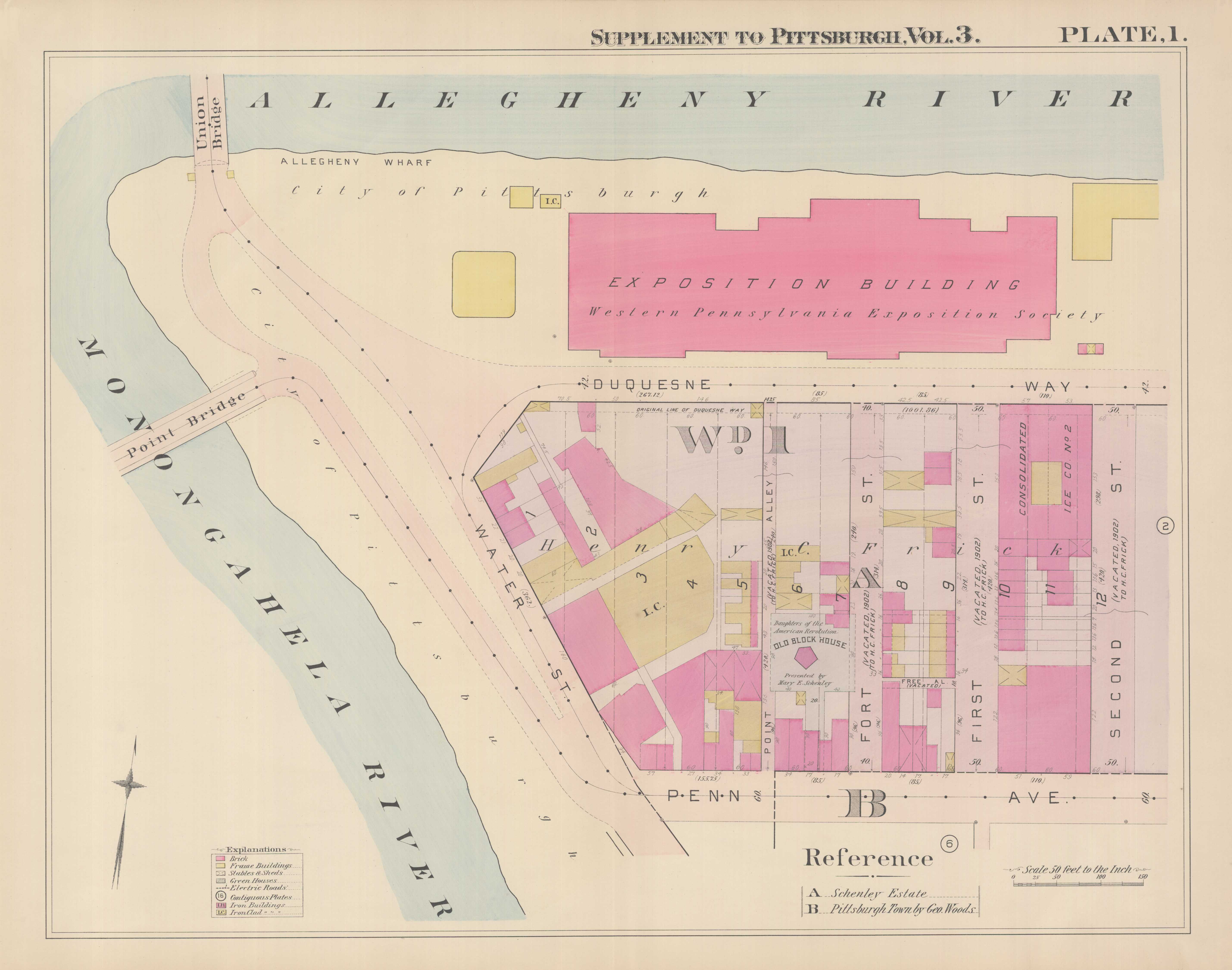
Description: This is a map published in 1900 of the area of Pittsburgh now known as Point State Park. Original description from the University of Pittsburgh: Real estate plat-book of the City of Pittsburgh : from official records, private plans and actual surveys. Volume 3 (1900) -- Wards 1-12, 15-17. [Downtown, Strip District, Hill District, Polish Hill, Lawrenceville, Bloomfield] Title: Plate 1 Creator: G. M. Hopkins & Co. Publisher: Philadelphia: G. M. Hopkins & Co. Dimension: 58 x 81 cm Scale: 50 Municipality: Pittsburgh Street: Fort st, First st, Duquesne way, Penn ave, Second st, Point al, Water st Land, Water, Other: Allegheny, Monongahela Identifier: 03sv3p01
Title: Pittsburgh Volume 3 Plate 1
Credit: http://images.library.pitt.edu/cgi-bin/i/image/image-idx?view=entry;cc=maps;entryid=x-03sv3p01
Author: G. M. Hopkins & Co.
Usage Terms: Public domain
License: Public domain
Attribution Required?: No
Image usage
The following 2 pages link to this image:
