
Image: Pizzigano
Size of this preview: 800 × 505 pixels. Other resolutions: 320 × 202 pixels | 4,360 × 2,752 pixels.
Original image (4,360 × 2,752 pixels, file size: 3.35 MB, MIME type: image/jpeg)
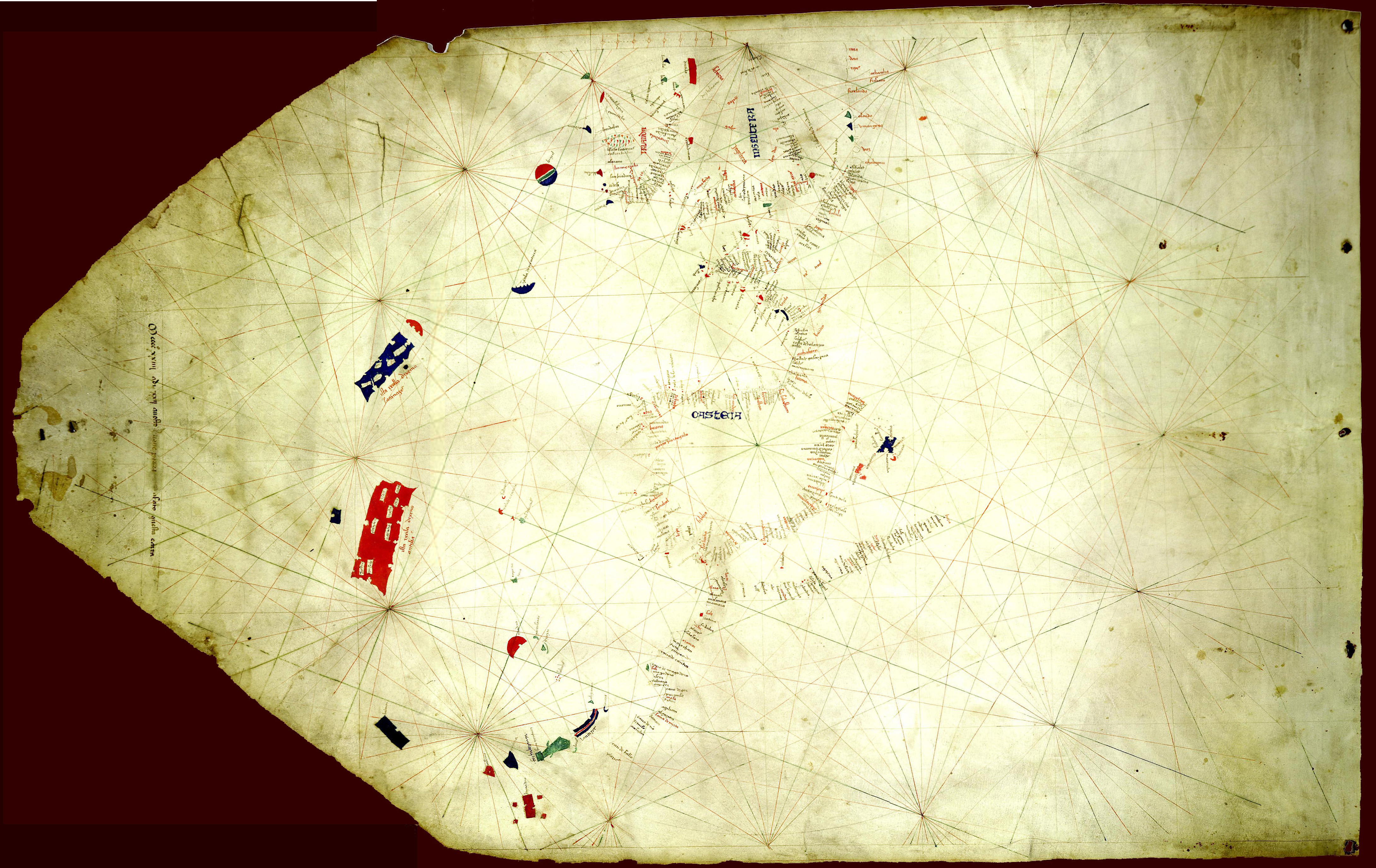
Description: The Pizzigano map, also known as the Pizzigano chart is an Italian portolan chart dated 1424. It contains islands in the North Atlantic Ocean in the west of Spain and Portugal including Portuguese discoveries and legendary islands such as Antillia. The cartographer may have been the Venetian Zuane Pizigano, possibly a descendant of a 14th century family of mapmakes one of whom authored another well known map also called the Pizziagano map in Parma in 1367
Title: Pizzigano
Credit: University of Minnesota Libraries 8 gemonteerde screenshots. Own work
Author: Pizzigiano, Zuane & XpoferenS
Usage Terms: Public domain
License: Public domain
Attribution Required?: No
Image usage
The following page links to this image:

All content from Kiddle encyclopedia articles (including the article images and facts) can be freely used under Attribution-ShareAlike license, unless stated otherwise.