
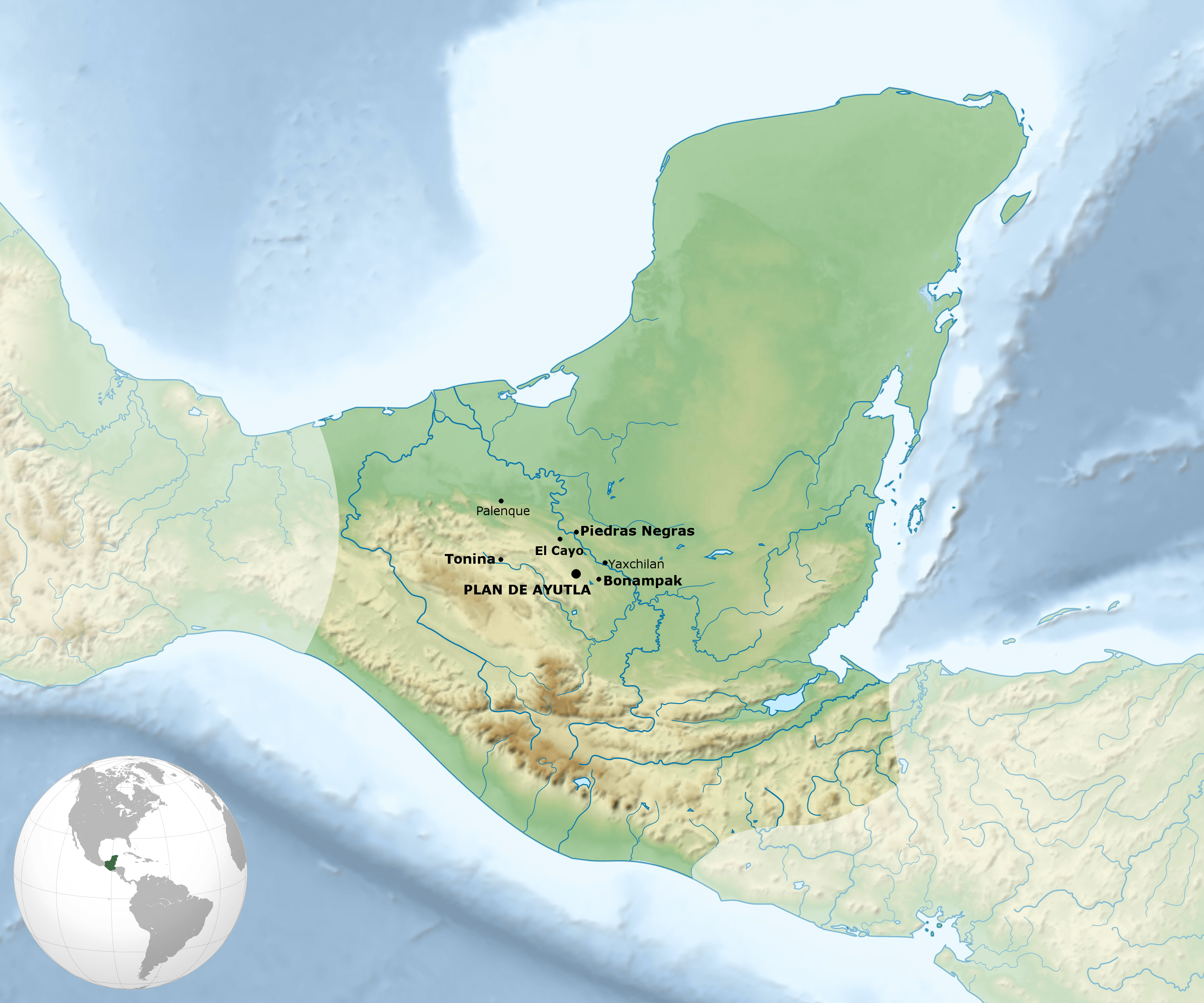
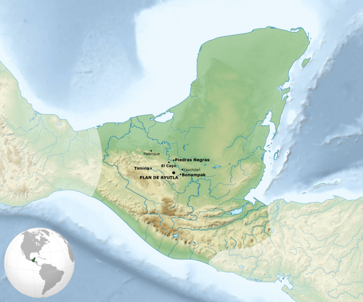
Image: Plan de Ayutla Location
Size of this preview: 720 × 600 pixels. Other resolutions: 288 × 240 pixels | 3,600 × 3,000 pixels.
Original image (3,600 × 3,000 pixels, file size: 2.22 MB, MIME type: image/png)
Description: A map of the Upper Usumacinta Maya polities with Plan de Ayutla Bolded
Title: Plan de Ayutla Location
Credit: Maya_civilization_location_map-blank.svg Sites_Mayas.png
Author: Maya_civilization_location_map-blank.svg: Sémhur Mayas.png: Yavidaxiu derivative work: Alvaradodavide
Usage Terms: Creative Commons Attribution-Share Alike 3.0
License: CC BY-SA 3.0
License Link: https://creativecommons.org/licenses/by-sa/3.0
Attribution Required?: Yes
Image usage
The following page links to this image:

All content from Kiddle encyclopedia articles (including the article images and facts) can be freely used under Attribution-ShareAlike license, unless stated otherwise.