
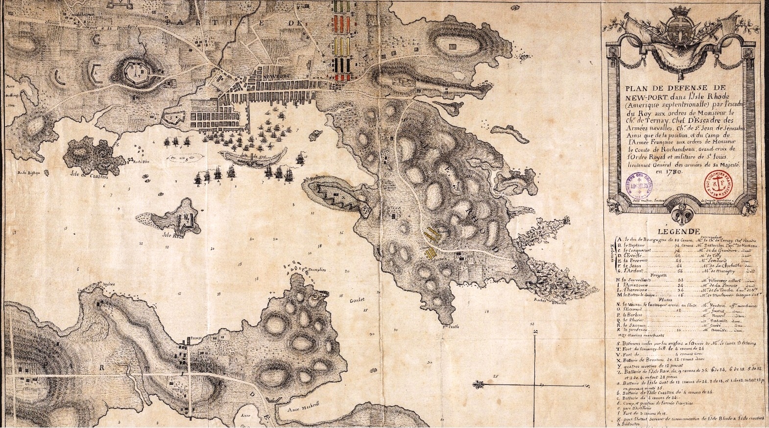
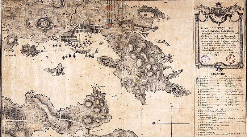
Image: Plan de stationnement des troupes francaise et de la marine a Newport en 1780
Description: Plan of the fortifications of Newport. By the squadron of the King (Louis XVI) orders of the Chevalier De Ternay Wing Leader, a Knight of St John of Jerusalem, and the position and the camp of the French Army under the orders of M. le Comte de Rochambeau, Grand Cross of the Order of St. Louis, Lieutenant General of the Armies of His Majesty in 1780. (rough translation) Map made by Mr. Mullon, lieutenant commander aboard the ship Hermione. Map legend with references giving names of ships and their commanders, fleet represented in the port; color indication of the different regiments.
Title: Plan de stationnement des troupes francaise et de la marine a Newport en 1780
Credit: http://anom.archivesnationales.culture.gouv.fr/sdx/ulysse/notice?id=FR CAOM 03DFC22B
Author: Mullon
Usage Terms: Public domain
License: Public domain
Attribution Required?: No
Image usage
The following page links to this image:
