Washington–Rochambeau Revolutionary Route facts for kids
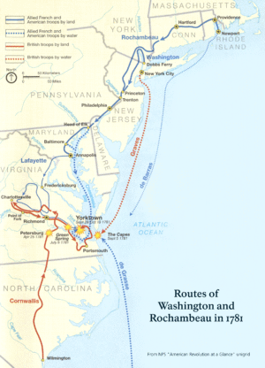
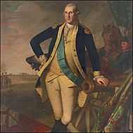
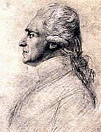
The Washington–Rochambeau Revolutionary Route is a 680-mile (1,094 km) long path. It is made of many roads used in 1781 by two armies. One was the American Continental Army led by George Washington. The other was the French army, called the Expédition Particulière, led by Jean-Baptiste de Rochambeau. They marched for 14 weeks from Newport, Rhode Island to Yorktown, Virginia. This route is now a special National Historic Trail. It has signs and exhibits that explain how France helped the United States win the American Revolutionary War.
Contents
Background: A Big Help from France
In 1780, King Louis XVI of France sent help to America. He sent General Rochambeau with 450 officers and 5,300 soldiers. They arrived in Narragansett Bay near Newport, Rhode Island on July 10, 1780.
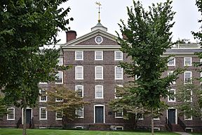
In June 1781, Rochambeau got ready to march. His goal was to meet George Washington and the American army. They planned to meet near White Plains, New York. Rochambeau split his army into four groups. One group stayed in Providence. They guarded supplies and helped injured soldiers at a hospital in University Hall.
The French soldiers left Providence on June 19. They marched 15 miles (24 km) to a camp near Connecticut. Then, they kept marching across Connecticut. They met George Washington's army at Dobbs Ferry, New York, on the Hudson River. An advance group, called Lauzun's Legion, marched ahead. They stayed 10 to 15 miles (16 to 24 km) south of the main army. This protected the side of the army from the British.
The American and French armies then marched together. They went through New Jersey, Pennsylvania, Delaware, and Maryland. This path helped them avoid British troops. They reached Williamsburg, Virginia in late September 1781. On September 22, they joined with troops led by the Marquis de Lafayette.
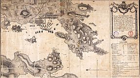
The French navy also helped a lot. They won the Battle of the Chesapeake on September 5, 1781. This stopped the British from sending more soldiers or rescuing their general, General Cornwallis. A three-week siege of Yorktown followed. General Cornwallis surrendered on October 19, 1781.
After the victory, Washington's army moved north. Rochambeau's army spent the winter in Williamsburg. Then, in the summer of 1782, they marched north to Boston, Massachusetts. Along the way, towns and cities cheered for them. It was a much warmer welcome than when they marched south.
The March: Rhode Island to New York
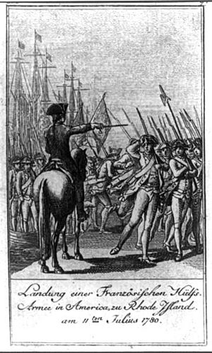
General Rochambeau and his officers left Newport, Rhode Island, on June 10, 1781. They arrived in Providence the next day. The rest of his army came by boat and camped in Providence. The French Army had a big parade in Providence on June 16. Then, they started marching towards Coventry, Rhode Island. They left in four groups, one group each day from June 18 to 21.
The army left their camp in Providence on June 19. They followed old roads, crossing the Pawtuxet River. Their first day's march was 15 miles (24 km). They stopped at Waterman's Tavern.
Waterman's Tavern: First Stop
Each group of soldiers had cannons, supplies, and a field hospital. Rochambeau himself left with the first group. He arrived at the second camp in Coventry on the evening of June 18. This camp was at Waterman's Tavern. The route from Providence to Coventry followed what are now Route 14 and Old Plainfield Pike.
Rochambeau's army marched from Coventry through Sterling, Connecticut. They followed Route 14A to their third camp in Plainfield. They arrived there on June 19. A 3.6-mile (5.8 km) part of this march route is now a historic place. This old road still has its narrow, winding feel. It also has stone walls along its sides. The French found this part of the march hard because of the difficult road.
Windham: Tough Roads
On June 20, Rochambeau's army kept marching. They went along Route 14A to Canterbury. Then they followed Route 14 through Canterbury and Scotland. They reached their fourth camp in Windham on the evening of June 20. This camp was by the Shetucket River.
Many parts of these old roads have changed over time. However, some short sections are still preserved. For example, Old Canterbury Road in Plainfield was bypassed by a new highway. It still looks much like it did back then, with low stone walls. Another preserved section is Manship Road in Canterbury. A part of Route 14 east of Scotland Center is also a preserved section. The French described this part as "a narrow, steep, and stony road."
Another preserved road is Scotland Road in Windham. This part was easier to march on. It now looks more modern, but it still has stone walls. The wide views of the land also help show its history.
Bolton: Through Forests
The French army continued marching through Connecticut on June 21. They went from Windham past Willimantic. They generally followed modern Route 14 and Route 66. They passed through Columbia and Andover. Their fifth camp was in Bolton. The original road to this camp is now overgrown by forest.
On June 22, the French army marched from Bolton. They followed Bolton Center Road and Middle Turnpike East. Then they took Route 6 to Silver Lane in East Hartford. This was the location of their sixth camp.
East Hartford: A Rest Stop
The four groups of soldiers had been marching one day apart. They rested for three nights in East Hartford. This meant they needed more camp spots in the same area. Route 6 is a busy highway now. The area around it is very developed. But two sections of the old road in Andover and Bolton are still preserved.
In Andover, the original route used Hutchinson Road and Bailey Road. A part of Hutchinson Road still has stone walls and old trees. It also has wide views of open fields. The Daniel White Tavern, built in 1773, is still there. French officers stayed at this tavern.
Bailey Road used to connect to Brandy Street in Bolton. The part in Bolton is now an unpaved path. It still has the old stone walls and two original stone tunnels for water.
Farmington: Crossing Rivers
The first group of Rochambeau's army crossed the Connecticut River by ferry on June 25. They went into Hartford. The other groups followed one day later. From Hartford, they traveled along Farmington Avenue. They went through West Hartford to Farmington. This was their seventh camp. Rochambeau and his officers are said to have stayed at the Elm Tree Inn.
After staying in Farmington, the army followed Route 10 on June 26. They went through Southington to the Milldale area. Then they went west along Route 322. They reached their eighth camp in the Marion part of Southington. Rochambeau and his officers stayed at the Asa Barnes Tavern.
The next day, they continued west along Route 322. Then they took Meriden Road into Waterbury. In Waterbury, they followed East Main Street and West Main Street. They crossed the Naugatuck River. The road west of Waterbury was very hard. The French called it "détestables" because it was stony and hilly. The route continued into Middlebury. Their ninth camp was at the bottom of Breakneck Hill. Rochambeau and his officers were guests at the Israel Bronson Tavern.
Newtown: Reorganizing Troops
On June 28, the first group continued marching south. They went through Middlebury and into Southbury. The army then crossed the Housatonic River into Newtown. They used a bridge built by American troops in 1778. They continued through Newtown. Their tenth camp was west of the town center. The officers stayed at Caleb Baldwin's Tavern.
Rochambeau changed his army into two larger groups in Newtown. The first group started marching again on June 30. They went west, then north, then west again on Route 6. A part of Reservoir Road is well preserved and is a historic site. The army marched along Route 6 and Newtown Road into Danbury. In Danbury, they used several streets to reach the Ridgebury area of Ridgefield. Their eleventh camp was set up on July 1 in Ridgebury.
Mount Kisco, NY: Meeting Washington
The French army continued its march on July 2. They went through Ridgefield, then crossed into New York state. They followed Route 121 past North Salem and Cross River. They reached Bedford Village. The first group camped in Bedford Village (their 12th camp). The second group skipped this camp. The French continued west along Route 172 to Mount Kisco.
The French stayed in Mount Kisco for several days. On July 6, they marched west and south for 16 miles (26 km). They followed Route 133 and Route 100 to the Hartsdale area. They camped in several places in Greenburgh (their 14th camp) for the next six weeks. This is where they finally met up with George Washington's American army.
The March: New York to Virginia
After meeting, the combined American and French armies marched south. They went through New Jersey, Pennsylvania, Delaware, and Maryland.
Philadelphia to Baltimore: A Quick Trip
Washington and Rochambeau left Philadelphia by September 5. Washington traveled by land. Rochambeau went by boat on the Delaware River. They met in Chester, Pennsylvania. There, Washington shared exciting news: the French navy had arrived in the Chesapeake Bay!
Washington hurried ahead to Head of Elk. This was where the Chesapeake Bay began to be deep enough for ships. He needed to find boats for transport. About 1,000 American and French soldiers went by boat to Jamestown. The rest of the army kept marching through Baltimore and Annapolis. In Baltimore, different groups of soldiers camped in various parts of the city. The allied forces left Baltimore on September 15.
Williamsburg and Alexandria: Final Push to Yorktown
Washington, Rochambeau, and their officers arrived in Williamsburg, Virginia on September 14. They gathered troops and supplies to start the siege at Yorktown. The allied supply wagons arrived in Alexandria, Virginia after a two-day march from Georgetown. They crossed the Potomac River. The wagons took up a large area in Alexandria.
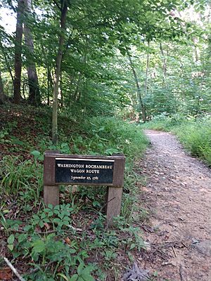
The wagon train left Alexandria on September 26. They headed west, then south. Washington had ordered a special wagon road to be built. This road led to Wolf Run Shoals on the Occoquan River. The combined American-French army followed this road. They crossed the Occoquan River on September 27. The wagons followed modern Virginia State Route 234 to Dumfries. Then they followed the King's Highway south. By the end of September, the wagons were at Trebell's Landing on the James River. From there, they were taken about six miles (10 km) overland to the battle lines at Yorktown. The soldiers who were with the wagons got off their boats near Williamsburg.
 | Mary Eliza Mahoney |
 | Susie King Taylor |
 | Ida Gray |
 | Eliza Ann Grier |


