Sterling, Connecticut facts for kids
Quick facts for kids
Sterling, Connecticut
|
||
|---|---|---|
| Town of Sterling | ||

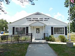
Sterling's post office
|
||
|
||
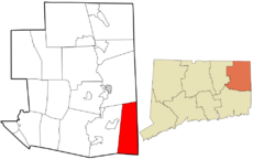
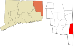
 Windham County and Connecticut Windham County and Connecticut |
||
| Country | ||
| U.S. state | ||
| County | Windham | |
| Region | Northeastern CT | |
| Incorporated | 1794 | |
| Government | ||
| • Type | Selectman-town meeting | |
| Area | ||
| • Total | 27.3 sq mi (70.7 km2) | |
| • Land | 27.2 sq mi (70.5 km2) | |
| • Water | 0.1 sq mi (0.2 km2) | |
| Elevation | 384 ft (117 m) | |
| Population
(2020)
|
||
| • Total | 3,578 | |
| • Density | 131.06/sq mi (50.61/km2) | |
| Time zone | UTC−5 (Eastern) | |
| • Summer (DST) | UTC−4 (Eastern) | |
| ZIP code |
06377, 06373
|
|
| Area code(s) | 860/959 | |
| FIPS code | 09-73420 | |
| GNIS feature ID | 0213512 | |
Sterling is a small town located in Windham County, Connecticut, United States. It is part of the Northeastern Connecticut Planning Region. In 2020, about 3,578 people lived here.
Sterling is a rural town with two main villages: Oneco and Sterling village. Each village has its own post office, a church, and a fire station. The town hall and the public library are in Oneco. The town's only public school is in Sterling village.
Contents
Sterling's History
How Sterling Got Its Name
The town of Sterling was named after John Sterling. He was one of the first people to settle in the area. Sterling officially became a town in 1794. It was created from the northern part of the town of Voluntown.
A Visit During the American Revolution
During the American Revolutionary War in 1781, a French general named Le Comte de Rochambeau marched through Sterling. He and his soldiers camped in the town. They were on their way to join George Washington's army on the Hudson River. Rochambeau's army had landed earlier in Narragansett Bay.
Early Industries
In 1800, the first cotton mill was built in Sterling. This was an important step for the town's economy. It helped create jobs and grow the community.
Famous People from Sterling
Charles Dow, who later became famous for creating the Dow Jones company, was born in Sterling.
Geography of Sterling
Sterling covers a total area of about 27.3 square miles (70.7 square kilometers). Most of this area, about 27.2 square miles (70.5 square kilometers), is land. Only a small part, about 0.1 square miles (0.2 square kilometers), is water.
People of Sterling
| Historical population | |||
|---|---|---|---|
| Census | Pop. | %± | |
| 1820 | 1,200 | — | |
| 1850 | 1,025 | — | |
| 1860 | 1,051 | 2.5% | |
| 1870 | 1,022 | −2.8% | |
| 1880 | 957 | −6.4% | |
| 1890 | 1,051 | 9.8% | |
| 1900 | 1,209 | 15.0% | |
| 1910 | 1,283 | 6.1% | |
| 1920 | 1,266 | −1.3% | |
| 1930 | 1,233 | −2.6% | |
| 1940 | 1,251 | 1.5% | |
| 1950 | 1,298 | 3.8% | |
| 1960 | 1,397 | 7.6% | |
| 1970 | 1,853 | 32.6% | |
| 1980 | 1,791 | −3.3% | |
| 1990 | 2,357 | 31.6% | |
| 2000 | 3,099 | 31.5% | |
| 2010 | 3,830 | 23.6% | |
| 2020 | 3,578 | −6.6% | |
| U.S. Decennial Census | |||
In 2000, there were 3,099 people living in Sterling. The town's population grew quite a bit between 2000 and 2010. It was one of the fastest-growing towns in Connecticut during that time.
Most people in Sterling are White. A small number of residents are Native American or Asian. Some people are also of Hispanic or Latino background.
The average age of people in Sterling in 2000 was 34 years old. About 28% of the population was under 18 years old.
Places to See in Sterling
- The Dorrance Inn is a historic building. It was added to the National Register of Historic Places in 2002. You can find it at 748 Plainfield Pike.
- The March Route of Rochambeau's Army: Plainfield Pike marks the path of General Rochambeau's army.
- The Sterling Hill Historic District (Plainfield and Sterling, Connecticut) is another historic area. It was added to the National Register in 1986.
Education in Sterling
Sterling has its own school called the Sterling Community School. This school is newer and replaced the old Sterling Memorial School.
For high school, students from Sterling usually go to Plainfield High School in Plainfield. However, students also have other choices. They can attend Killingly High School, Harvard H. Ellis Technical High School, Quinebaug Middle College, or ACT High School.
Notable People from Sterling
- Charles Dow (1851–1902): He was a journalist who founded the Dow Jones & Company. He was born in Sterling.
- Allen Cleveland Lewis (1821–1877): He founded the Lewis Institute, which later became part of the Illinois Institute of Technology. He was also born in Sterling.
- Tom "T-Bone" Stankus: A musician.
See also
 In Spanish: Sterling (Connecticut) para niños
 | DeHart Hubbard |
 | Wilma Rudolph |
 | Jesse Owens |
 | Jackie Joyner-Kersee |
 | Major Taylor |


