Bolton, Connecticut facts for kids
Quick facts for kids
Bolton, Connecticut
|
||
|---|---|---|

|
||
|
||
| Motto(s):
"A Town for All Seasons"
|
||
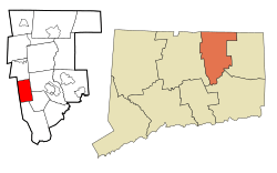
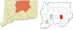
 Tolland County and Connecticut Tolland County and Connecticut |
||
| Country | ||
| U.S. state | ||
| County | Tolland | |
| Region | Capitol Region | |
| Incorporated | 1720 | |
| Government | ||
| • Type | Selectman-town meeting | |
| Area | ||
| • Total | 14.7 sq mi (38.1 km2) | |
| • Land | 14.4 sq mi (37.3 km2) | |
| • Water | 0.3 sq mi (0.8 km2) | |
| Elevation | 728 ft (222 m) | |
| Population
(2020)
|
||
| • Total | 4,858 | |
| • Density | 330.2/sq mi (127.51/km2) | |
| Time zone | UTC−5 (Eastern) | |
| • Summer (DST) | UTC−4 (Eastern) | |
| ZIP Code |
06043
|
|
| Area code(s) | 860/959 | |
| FIPS code | 09-06260 | |
| GNIS feature ID | 0213393 | |
| List of auxiliary Interstate Highways | ||
| U.S. Highways | ||
| State Routes | ||
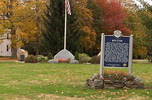
Bolton (pronounced BOHL-tuhn) is a small, quiet town in Tolland County, Connecticut, United States. It's known for its beautiful rural areas. In 2020, about 4,858 people lived here. Bolton became an official town in October 1720. It's run by a town meeting system, with a first selectman and a board of selectmen who help manage things. The town was named after another town called Bolton in England.
Contents
Exploring Bolton's Past
Bolton was once part of Hartford. People used to call this area Hartford Mountains or Hanover. Then, in October 1720, it became its own town. A famous pastor named Jonathan Edwards started working in Bolton in 1723.
In the 1700s, Bolton was famous for its high-quality stone, called schist. Many artists who carved tombstones, like Gershom Bartlett, got their stone from Bolton's quarries.
Bolton left Hartford County when Tolland County was created in 1785. Later, in 1808, the northern part of Bolton became the town of Vernon. Quarries were very important for the town's economy. The area called Bolton Notch became home to a small community known as Quarryville. Before railroads, granite from the quarries was taken by oxcart to the Connecticut River. From there, it was shipped to big cities on the East Coast.
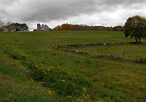
The Bolton Historical Society works hard to protect the town's history. They buy important sites to keep Bolton's rural feel. One recent purchase was Rose's Farm. This large area was where the Comte de Rochambeau and his troops camped a long time ago.
Bolton has many parks, open spaces, and trails for everyone to enjoy.
How Bolton's Roads Changed
A major highway, Interstate 84, was once planned to go through Bolton. It would have passed through Bolton Notch and the Hop River valley on its way to Providence. However, because of environmental concerns, the highway plan was canceled in 1983. The part that was already built in the northwestern section of town became Interstate 384.
Today, Bolton is mostly a residential town. This means many people live here in suburban homes, especially on the western side. The town's economy is made up of mostly small businesses. Bolton is part of the larger Greater Hartford metro area.
Bolton's Weather and Seasons
Bolton experiences a climate that has features of both humid continental climates. This means it has warm summers and cold, snowy winters.
| Climate data for Bolton, Connecticut | |||||||||||||
|---|---|---|---|---|---|---|---|---|---|---|---|---|---|
| Month | Jan | Feb | Mar | Apr | May | Jun | Jul | Aug | Sep | Oct | Nov | Dec | Year |
| Record high °F (°C) | 64 (18) |
69 (21) |
83 (28) |
93 (34) |
92 (33) |
96 (36) |
97 (36) |
96 (36) |
96 (36) |
86 (30) |
78 (26) |
71 (22) |
97 (36) |
| Mean daily maximum °F (°C) | 35 (2) |
38 (3) |
47 (8) |
58 (14) |
69 (21) |
76 (24) |
81 (27) |
80 (27) |
72 (22) |
62 (17) |
51 (11) |
40 (4) |
59 (15) |
| Mean daily minimum °F (°C) | 13 (−11) |
15 (−9) |
24 (−4) |
33 (1) |
43 (6) |
52 (11) |
57 (14) |
56 (13) |
46 (8) |
35 (2) |
29 (−2) |
20 (−7) |
35 (2) |
| Record low °F (°C) | −32 (−36) |
−27 (−33) |
−24 (−31) |
4 (−16) |
20 (−7) |
27 (−3) |
34 (1) |
28 (−2) |
19 (−7) |
13 (−11) |
−5 (−21) |
−19 (−28) |
−32 (−36) |
| Average precipitation inches (mm) | 4.38 (111) |
3.11 (79) |
4.32 (110) |
4.54 (115) |
3.96 (101) |
4.25 (108) |
4.08 (104) |
4.07 (103) |
4.54 (115) |
4.56 (116) |
4.64 (118) |
4.02 (102) |
50.47 (1,282) |
| Source: The Weather Channel (Historical Monthly Averages) | |||||||||||||
Learning in Bolton
Bolton High School is a public school for students in the town. It usually has about 200 to 300 students. In 2011, the school had big renovations and additions. These included a new outdoor eating area, a bigger and more modern library, and new computer labs. They also added a new science wing and larger offices for the school's leaders. Parking and bus lanes were also improved.
The school has a great student-teacher ratio, which means there are about 12 students for every teacher. This allows for more personal attention. About 92.5% of students are good at math and reading. U.S. News & World Report ranked Bolton High School as #27 in Connecticut and #1030 in the entire United States in 2012. The school also received a Silver Award that year.
Bolton High School is part of the NCCC athletic conference, which means its sports teams compete against other schools in the area.
Bolton's Location and Size
According to the United States Census Bureau, the town of Bolton covers about 14.7 square miles (38.1 square kilometers). Most of this area, about 14.4 square miles (37.3 square kilometers), is land. The rest, about 0.3 square miles (0.8 square kilometers), is water. This area includes the Bolton Green Historic District.
Who Lives in Bolton?
| Historical population | |||
|---|---|---|---|
| Census | Pop. | %± | |
| 1820 | 731 | — | |
| 1850 | 600 | — | |
| 1860 | 683 | 13.8% | |
| 1870 | 576 | −15.7% | |
| 1880 | 512 | −11.1% | |
| 1890 | 452 | −11.7% | |
| 1900 | 457 | 1.1% | |
| 1910 | 433 | −5.3% | |
| 1920 | 448 | 3.5% | |
| 1930 | 504 | 12.5% | |
| 1940 | 728 | 44.4% | |
| 1950 | 1,279 | 75.7% | |
| 1960 | 2,933 | 129.3% | |
| 1970 | 3,691 | 25.8% | |
| 1980 | 3,951 | 7.0% | |
| 1990 | 4,575 | 15.8% | |
| 2000 | 5,017 | 9.7% | |
| 2010 | 4,980 | −0.7% | |
| 2020 | 4,858 | −2.4% | |
| U.S. Decennial Census | |||
In 2010, there were 4,980 people living in Bolton. Most families in Bolton are middle-class. There are also some working-class and upper-middle-class families. The town has many small businesses. One larger company is Simoniz, which makes cleaning supplies for cars.
In 2010, there were about 346 people living in each square mile of Bolton. Most homes in Bolton are owned by the people who live in them (about 86.7%). Only a small number (13.3%) are rented.
The people living in Bolton are mostly White (95.7%). There are also people who identify as African American (1.1%), Asian (1.4%), and other races. About 3% of the population identifies as Latino or Hispanic.
The average age of people in Bolton in 2010 was 45.4 years old. About 49.4% of the population was male and 50.6% was female.
Famous People from Bolton
- Aloysius Ahearn – A teacher and politician who served in the Connecticut House of Representatives.
- Ralph Earl – A well-known artist who painted portraits. He passed away in Bolton in 1801.
- Ron Hainsey – An NHL hockey player who was an alternate captain for the Ottawa Senators and won the Stanley Cup.
- Simeon Olcott – A US Senator from New Hampshire, born in Bolton in 1735.
- Julius L. Strong (1828–1872) – A U.S. Congressman.
- George G. Sumner – A politician who served in the Connecticut House of Representatives for Bolton. He was also the Mayor of Hartford and Lieutenant Governor and Governor of Connecticut. He was born in Bolton.
- William Williams – Born in Bolton on September 6, 1815.
See also
 In Spanish: Bolton (Connecticut) para niños
 | Janet Taylor Pickett |
 | Synthia Saint James |
 | Howardena Pindell |
 | Faith Ringgold |


