Shetucket River facts for kids
Quick facts for kids Shetucket River |
|
|---|---|

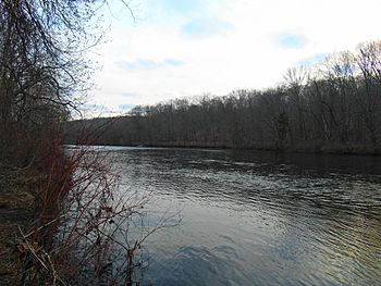
The river at Salt Rock State Park in Sprague
|
|

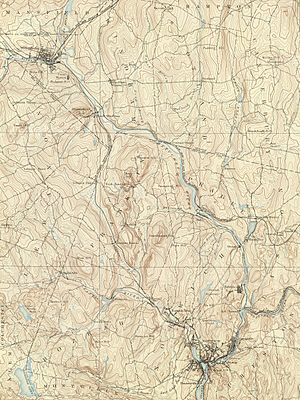
Shetucket River and environs
|
|
| Country | United States |
| State | Connecticut |
| Counties | Windham, New London |
| Physical characteristics | |
| Main source | Confluence of Willimantic River and Natchaug River Willimantic, Windham County, Connecticut, United States 41°42′46″N 72°11′31″W / 41.71278°N 72.19194°W |
| River mouth | Confluence with Yantic River to form Thames River Norwich, New London County, Connecticut, United States 41°31′20″N 72°04′40″W / 41.52222°N 72.07778°W |
| Length | 20 mi (32 km) |
| Basin features | |
| Tributaries | |
The Shetucket River is a river in eastern Connecticut, United States. It flows for about 20 miles (32 kilometers) and eventually joins the Thames River.
The Shetucket River begins in Willimantic. It forms where two other rivers, the Willimantic and Natchaug, meet. From there, it flows mostly southeast. About 4 miles (6 kilometers) northeast of Norwich, it meets the Quinebaug River. At this point, the river gets much wider, forming an estuary that stretches for about 5 miles (8 kilometers). This wide part then connects with the Thames River estuary near Norwich.
Even though the area around the river has a history of industry, the Shetucket River flows through a mostly rural part of New England. Some parts of the river are even special. The government has named them part of the Quinebaug and Shetucket Rivers Valley National Heritage Corridor. The National Park Service calls this river valley the "last green valley." This is because it's a dark, natural area in satellite photos, standing out from the bright lights of cities like Boston and Washington.
Bridges and Crossings
Many bridges cross the Shetucket River, connecting different towns and roads. These crossings are important for travel and transportation in the region. Here are some of the main ones:
| Carries | Location |
|---|---|
| Norwich | |
| Providence and Worcester Railroad | |
| 8th Street | |
| Providence and Worcester Railroad | Norwich/ |
| Bridge Street/Main Street | Norwich/ |
| Sprague | |
| Windham | |
| Providence and Worcester Railroad | |
| Plains Road |
Paddling Adventures
The Shetucket River is a great place for outdoor activities like canoeing and kayaking. The entire river, along with the lower part of the Natchaug River that flows into it, is a popular route for paddling.
Launch Sites
You can start your paddling trip from several places along the river:
- Lauter Park off Route 195 in Willimantic (on the Natchaug River, about 1 mile before it joins the Shetucket River).
- Recreation Park on Plains Road in Windham.
- Baltic Riverside Park on Route 97 in Sprague.
- Occum Dam canoe portage in Sprague.
- Lisbon Canoe Launch off Route 169 in Lisbon.
- Greenville Dam canoe portage in Norwich.
- Howard Brown Park in Norwich.
Dam Portages
Along the river, you will find four hydroelectric dams. These dams are used to generate electricity. When you reach a dam, you will need to carry your canoe or kayak around it. These spots are called "portages" and are usually marked. The dams requiring portages are Scotland Dam, Occum Dam, Taftville Dam, and Greenville Dam.
 | Jewel Prestage |
 | Ella Baker |
 | Fannie Lou Hamer |

