Natchaug River facts for kids
Quick facts for kids Natchaug River |
|
|---|---|

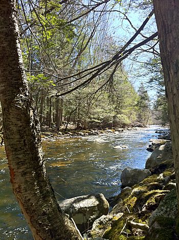
Bigelow Brook from the Natchaug Trail in Eastford Connecticut, the head waters of the Natchaug River.
|
|
|
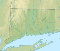
Location of the mouth within Connecticut
|
|
| Country | United States |
| State | Connecticut |
| Counties | Tolland, Windham |
| Physical characteristics | |
| Main source | Confluence of Still River and Bigelow Brook. Nearby Charlie Brown Campground Eastford, Windham County, Connecticut, United States 41°51′51″N 72°05′24″W / 41.86406°N 72.09005°W |
| River mouth | Confluence with Willimantic River to form Shetucket River Willimantic, Windham County, Connecticut, United States 41°42′46″N 72°11′30″W / 41.71278°N 72.19167°W |
The Natchaug River is a river about 17.9-mile-long (28.8 km) in northeastern Connecticut. It flows through Windham and Tolland Counties. The name Natchaug comes from the Nipmuc language. People believe it means land between rivers.
Contents
The River's Journey
The Natchaug River starts in Eastford, Connecticut. This is where two smaller waterways, Bigelow Brook and the Still River, join together. From there, the Natchaug River flows south. It runs next to Connecticut Route 198.
Exploring Natchaug State Forest
The river also flows along the edge of the main Natchaug State Forest. In some spots, it even goes right through the forest! This part of the river is a great place for outdoor fun. You can have picnics by the water or go fishing. Many people also enjoy whitewater rafting here because of the exciting rapids. When the weather is warm in the summer, this area gets very busy.
Continuing South
After leaving the forest, the Natchaug River turns and flows more towards the southwest. It still runs alongside Connecticut Route 198. Before it enters the town of Chaplin, you can find Diane's Pool. This is another popular spot where local people like to swim.
The river keeps flowing southwest. It then enters Windham and runs next to U.S. Route 6. Finally, it flows into Mansfield Hollow Lake, which is close to the Windham Airport.
Through Reservoirs
The Natchaug River then flows out of Mansfield Hollow Lake through the Mansfield Hollow Dam. At this point, it also carries water from the Mount Hope River and the Fenton River, which flowed into Mansfield Hollow Lake.
After the dam, the Natchaug River forms a border. It separates the towns of Mansfield and Windham. It also marks the line between Windham County and Tolland County.
The river then flows into and out of the Willimantic Reservoir. This reservoir is used to provide drinking water for people, so you cannot use it for fun activities like swimming or boating. Finally, the Natchaug River enters Willimantic. Here, it joins the Willimantic River. When these two rivers meet, they form a new river called the Shetucket River.
River Features
Along much of the Natchaug River, you can see large rocks and fast-moving water called rapids. Just south of the Mansfield Hollow Lake, near US 6, the river makes a small curve. This curve is called an oxbow. Because of this oxbow, the border between Windham and Mansfield moves away from the river for a short distance.
River Crossings
Many roads and trails cross over the Natchaug River. Here are some of them:
| County | Town | Carriers |
|---|---|---|
| Windham | Chaplin | Morey Rd. |
| Marcy Rd. | ||
| N. Bear Hill Rd. | ||
| England Rd. | ||
| Windham | Mansfield Rd. | |
| Tolland | Mansfield | None |
| Windham | Windham | |
| Airline State Park Trail | ||
Whitewater Rafting Adventures
The Natchaug River is a popular spot for people who love whitewater rafting. This is because of its fast-moving water and exciting rapids. There's a particularly challenging part of the river in Chaplin. This section is less than a mile long, but it's very intense! It's rated as Class IV on the International Scale of River Difficulty. This means it has very difficult rapids and even some small waterfall-like drops.
Fishing in the Natchaug River
Many fishermen in the area enjoy fishing in the Natchaug River. The Connecticut Department of Environmental Protection regularly adds trout to the river. This is called "stocking." Besides trout, you can find several other types of fish swimming in its waters.
 | Leon Lynch |
 | Milton P. Webster |
 | Ferdinand Smith |


