
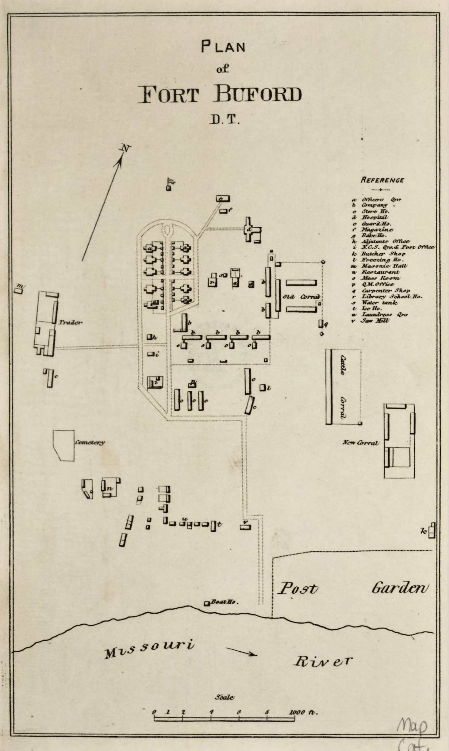
Image: Plan of Fort Buford
Size of this preview: 358 × 599 pixels. Other resolutions: 143 × 240 pixels | 1,464 × 2,449 pixels.
Original image (1,464 × 2,449 pixels, file size: 3.54 MB, MIME type: image/png)
Description: Map showing plan of Fort Buford, Dakota Territory, established June 15, 1866. Surveyed July, 1873. Seven sets of barracks
Title: Plan of Fort Buford
Credit: Outline Descriptions of the Posts in the Military Division of the Missouri, commanded by Lieutenant General P. H. Sheridan. Chicago, 1876. https://archive.org/details/GR_4327
Author: Unknown authorUnknown author
Usage Terms: Public domain
License: Public domain
Attribution Required?: No
Image usage
The following page links to this image:

All content from Kiddle encyclopedia articles (including the article images and facts) can be freely used under Attribution-ShareAlike license, unless stated otherwise.