
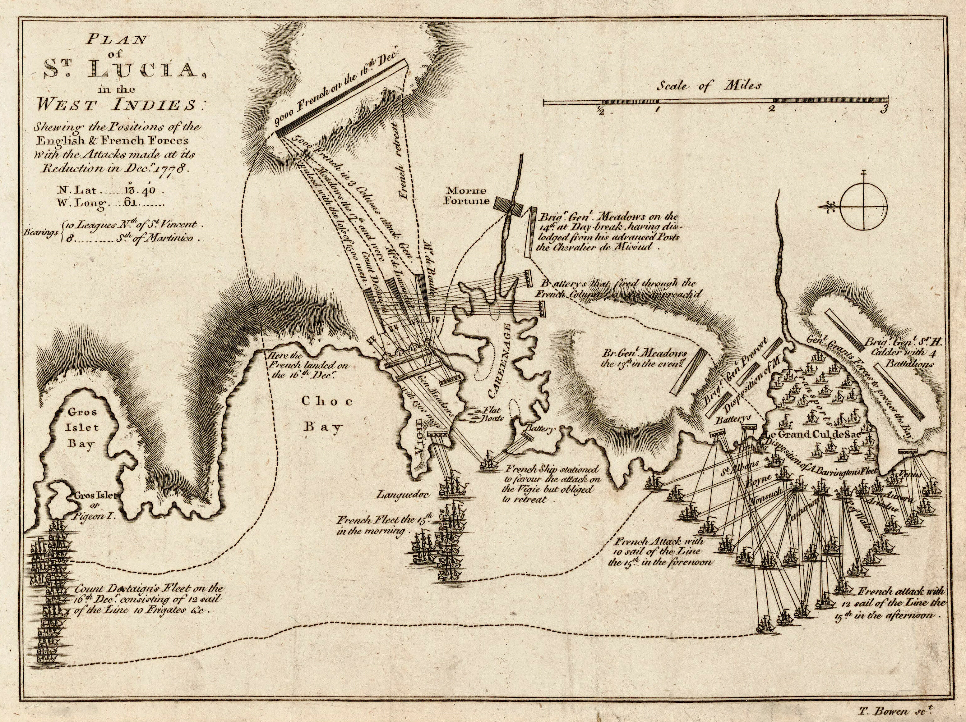
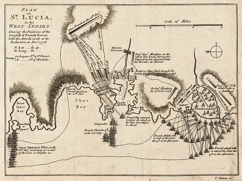
Image: Plan of St. Lucia, in the West Indies- Shewing the positions of the English and French forces with the attacks made at its reduction in Decr. 1778. LOC 74696150
Description: Scale ca. 1:51,000. Relief shown by hachures. Oriented with north to the left. Shows attacks made on Dec. 13-Dec. 16. Includes descriptive text. LC Maps of North America, 1750-1789, 2073 Available also through the Library of Congress Web site as a raster image. Vault AACR2: 651/1; 651/2
Title: Plan of St. Lucia, in the West Indies- Shewing the positions of the English and French forces with the attacks made at its reduction in Decr. 1778. LOC 74696150
Credit: https://www.loc.gov/item/74696150/
Author: Bowen, Thomas
Permission: This map is available from the United States Library of Congress's Geography & Map Division under the digital ID g5111s.ar207300. This tag does not indicate the copyright status of the attached work. A normal copyright tag is still required. See Commons:Licensing.
Usage Terms: Public domain
License: Public domain
Attribution Required?: No
Image usage
The following 3 pages link to this image:
