
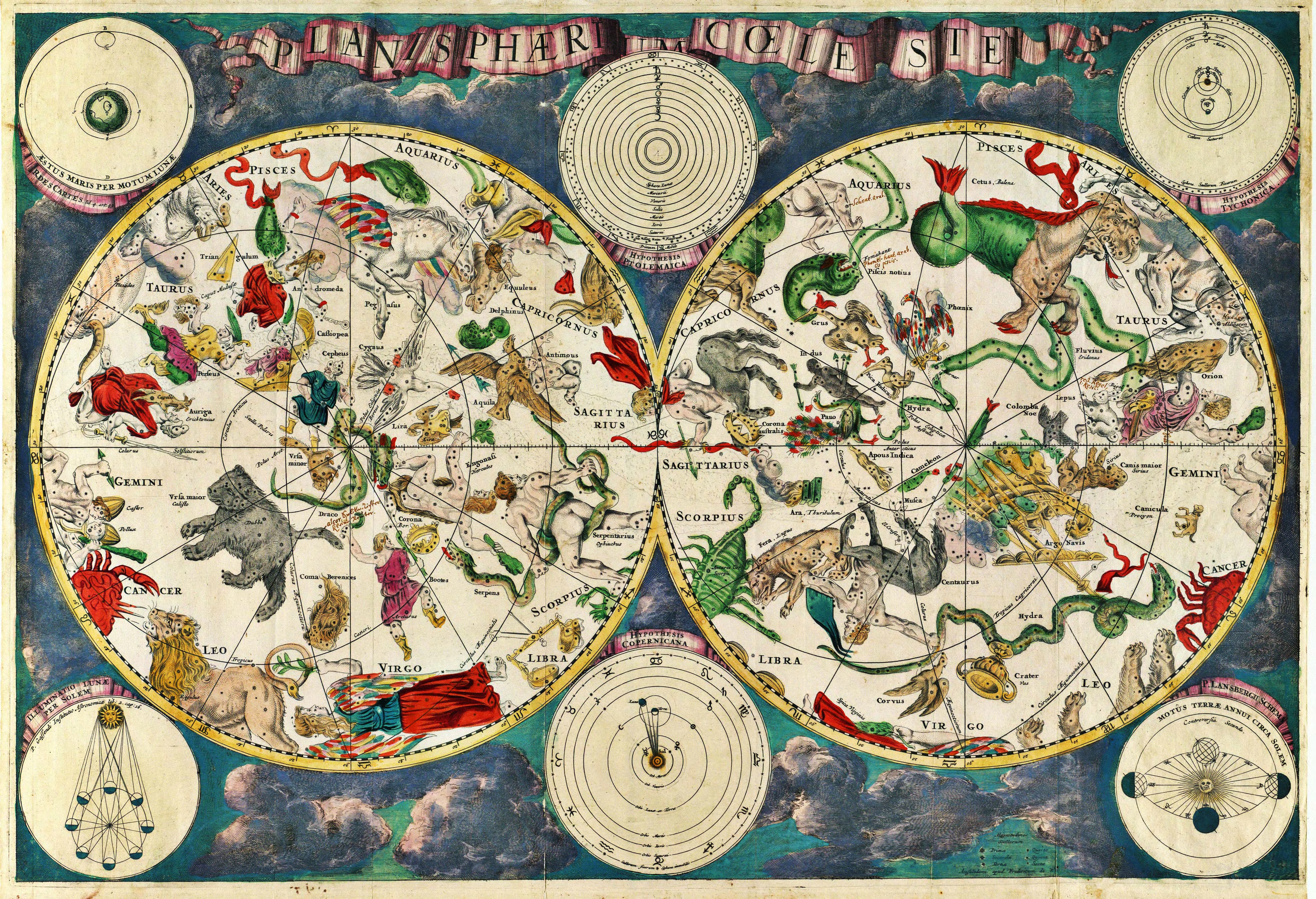
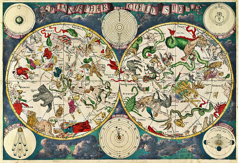
Image: Planisphæri cœleste
Size of this preview: 800 × 547 pixels. Other resolutions: 320 × 219 pixels | 5,812 × 3,972 pixels.
Original image (5,812 × 3,972 pixels, file size: 19.07 MB, MIME type: image/jpeg)
Description: Celestial map from the 17th century, by the Dutch cartographer Frederik de Wit.
Title: Planisphæri cœleste
Credit: Transferred from en.wikipedia to Commons. Scanned by Janke
Author: Frederik de Wit
Usage Terms: Public domain
License: Public domain
Attribution Required?: No
Image usage
The following 4 pages link to this image:

All content from Kiddle encyclopedia articles (including the article images and facts) can be freely used under Attribution-ShareAlike license, unless stated otherwise.