
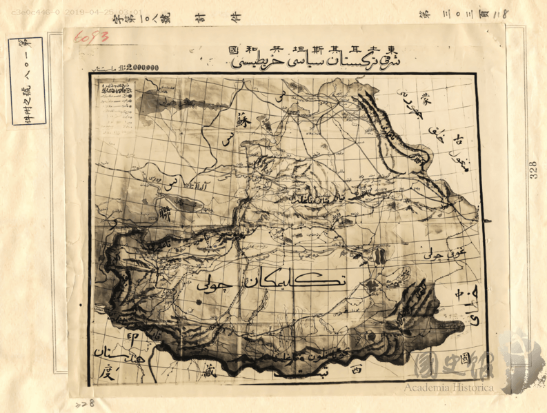
Image: Political Map Republic of East Turkestan Government 1947

Size of this preview: 793 × 599 pixels. Other resolutions: 318 × 240 pixels | 1,814 × 1,371 pixels.
Original image (1,814 × 1,371 pixels, file size: 1.49 MB, MIME type: image/png)
Description: Political map of East Turkistan made in 1947 by the government of the Republic of East Turkistan.
Title: Political Map Republic of East Turkestan Government 1947
Credit: Uyghur Academy - https://www.akademiye.org/ug/?p=14699
Author: Government of the East Turkistan Republic, 1947. (شەرقىي تۈركىستان جۇمھۇرىيەت ھۆكۈمىتى تەرىپىدىن 1947-يىلى )
Usage Terms: Public domain
License: Public domain
Attribution Required?: No
Image usage
The following page links to this image:

All content from Kiddle encyclopedia articles (including the article images and facts) can be freely used under Attribution-ShareAlike license, unless stated otherwise.