
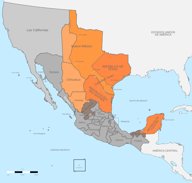
Image: Political divisions of Mexico 1836-1845 (location map scheme)

Size of this PNG preview of this SVG file: 631 × 600 pixels. Other resolution: 252 × 240 pixels.
Original image (SVG file, nominally 649 × 617 pixels, file size: 467 KB)
Description: Political divisions of Mexico 1836-1845. Territory proclaimed its independency Territory claimed by the Republic of Texas Territory claimed by the Republic of the Rio Grande Rebellions
Title: Political divisions of Mexico 1836-1845 (location map scheme)
Credit: Own work Instituto Nacional de Estadística y Geografía (INEGI) File:Political divisions of Mexico 1836 (location map scheme).svg : Giggette derivative work Giggette
Author: Giggette
Usage Terms: Creative Commons Attribution-Share Alike 3.0
License: CC BY-SA 3.0
License Link: https://creativecommons.org/licenses/by-sa/3.0
Attribution Required?: Yes
Image usage
The following 3 pages link to this image:

All content from Kiddle encyclopedia articles (including the article images and facts) can be freely used under Attribution-ShareAlike license, unless stated otherwise.
.svg)