
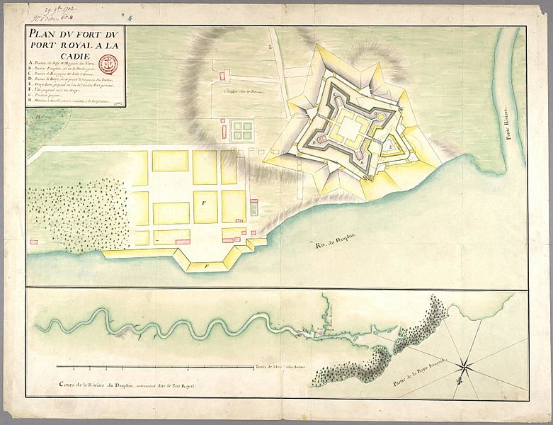
Image: PortRoyalAcadia1702

Size of this preview: 781 × 600 pixels. Other resolutions: 313 × 240 pixels | 2,000 × 1,536 pixels.
Original image (2,000 × 1,536 pixels, file size: 379 KB, MIME type: image/jpeg)
Description: A military engineering map of the fort at Port Royal, Acadia
Title: PortRoyalAcadia1702
Credit: Archives Canada-France: http://bd.archivescanadafrance.org/acf/doc.xsp?l=en&id=FRCAOM_Canada002_frcaom3dfc60b&base=fa&fmt=tab&qid=sdx_q0&from=&ss=true From the French Overseas Archive, number FR CAOM 3DFC60B
Author: attributed to Jean de Labat
Usage Terms: Public domain
License: Public domain
Attribution Required?: No
Image usage
The following 3 pages link to this image:

All content from Kiddle encyclopedia articles (including the article images and facts) can be freely used under Attribution-ShareAlike license, unless stated otherwise.