
Image: Proposed Map of C and O Canal
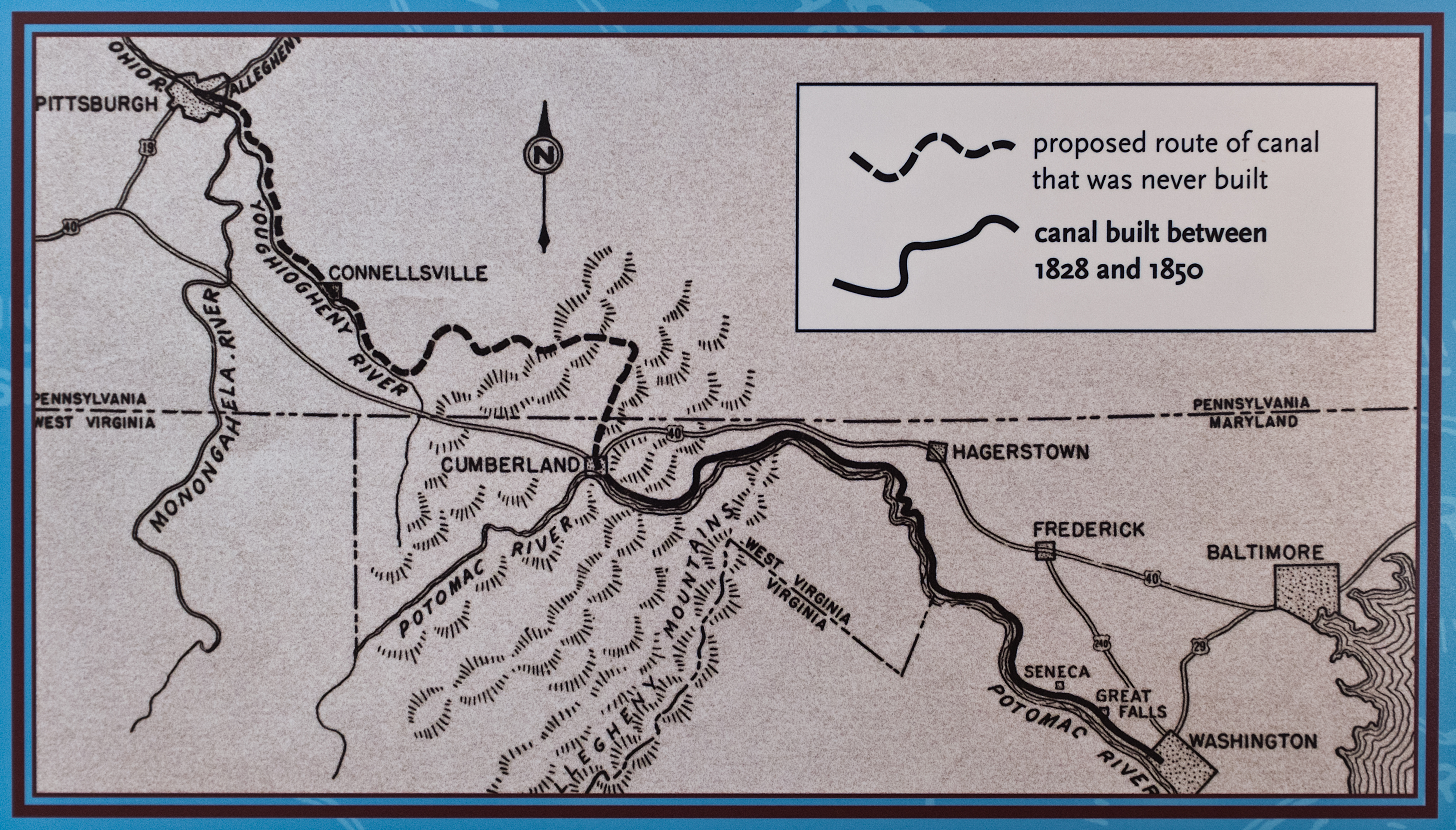
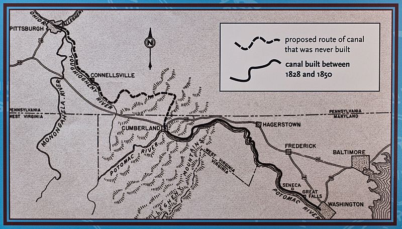
Description: Proposed Map of Chesapeake and Ohio Canal, including portions never built. The line follows Wills Creek north from Cumberland to Hyndman PA, continues north up Little Wills Creek north and west. It crosses the Eastern Divide, follows Buffalo Creek (just south of Berlin PA) to Garret PA on the Casselman River. It then follows the Casselman river to the Youghiogheny River at Confluence, PA, then to Connellsville PA.
Title: Proposed Map of C and O Canal
Credit: United States Dept. of Interior. National Park Service information sign in Great Falls Tavern, Great Falls, MD, on the Chesapeake and Ohio Canal. It is one of several which are part of the historical exhibit of the Canal. This image is a work of the United States Department of the Interior, taken or made as part of that person's official duties. As a work of the U.S. federal government, the image is in the public domain.
Author: United States Dept. of Interior, National Park Service
Usage Terms: Public domain
License: Public domain
Attribution Required?: No
Image usage
The following 2 pages link to this image:
