
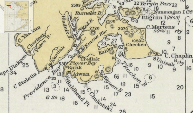
Image: Providence Bay Region 1928
No higher resolution available.
Providence_Bay_Region_1928.PNG (751 × 443 pixels, file size: 634 KB, MIME type: image/png)
Description: Section of the 1928 US Coast Survey Bering Sea chart showing Providence (Provideniya) Bay and surrounding area, in Chukotka Autonomous Okrug.
Title: Providence Bay Region 1928
Credit: Historical map and chart project. Office of Coast Survey, NOAA, USA
Author: Office of Coast Survey, NOAA, USA
Usage Terms: Public domain
License: Public domain
Attribution Required?: No
Image usage
The following page links to this image:

All content from Kiddle encyclopedia articles (including the article images and facts) can be freely used under Attribution-ShareAlike license, unless stated otherwise.