Providence Bay facts for kids
Quick facts for kids Providence Bay |
|
|---|---|
| Emma Harbor, Plover Bay, Ureliki | |
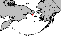
Location of Providence Bay in the Bering Sea
|
|
| Location | Far North |
| Coordinates | 64°25′00″N 173°24′00″W / 64.41667°N 173.40000°W |
| Native name | Бу́хта Провиде́ния Error {{native name checker}}: parameter value is malformed (help) |
| Ocean/sea sources | Bering Sea |
| Basin countries | Russia |
| Max. width | 34 km (21 mi) |
| Average depth | 150 m (490 ft) |
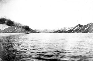
Providence Bay (Russian: Бу́хта Провиде́ния) is a long, narrow inlet of the sea, also known as a fjord, located on the southern coast of the Chukchi Peninsula in northeastern Siberia, Russia. For many years in the 1800s and early 1900s, it was a popular place for whalers and traders to meet, spend the winter, and get supplies.
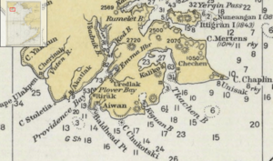
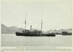
Emma Harbor (now called Komsomolskaya Bay) is a large, safe bay found on the eastern side of Providence Bay. The towns of Provideniya and Ureliki, along with the Provideniya Bay Airport, are located on Komsomolskaya Bay. Sometimes, in English writings, Plover Bay refers to a specific safe spot for ships inside Providence Bay, called Port Providence. However, it was often used to mean the whole Providence Bay.
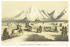
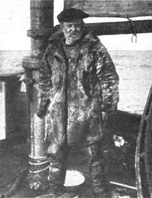
Plover Bay got its name from HMS Plover, a British ship. This ship spent the winter in Emma Harbor in 1848-1849. HMS Plover, led by Captain Thomas E. L. Moore, left England in January 1848. Its mission was to search the Bering Sea for the lost Franklin Expedition. On October 17, 1848, Captain Moore anchored his ship in a safe spot. He is credited with naming Providence Bay and being the first to successfully winter a ship in the Bering Sea region.
Contents
Exploring Providence Bay's Geography
The entrance to Providence Bay is marked by two points of land. On the east is Mys Lysaya Golova (also called East Head or Baldhead Point). On the west is Mys Lesovskogo. Mys Lysaya Golova is about 7 miles (11 km) west-northwest of Cape Chukotsky.
Providence Bay is about 8 km (5 miles) wide at its opening. It stretches for about 34 km (21 miles) in length. For much of its lower part, it is about 4 km (2.5 miles) wide. The bay narrows to about 2.5 km (1.5 miles) just before Emma Harbor. The lower part of the bay goes mostly northeast. The upper part, above a branch called Ked Bay, turns north and is about 2 km (1.2 miles) wide. The deepest parts of the bay can reach about 150 meters (490 feet).
Emma Harbor and Other Safe Spots
Emma Harbor has been called "the best harbor on the Asiatic coast." It is currently the most important harbor in Providence Bay. It is like a fjord itself, located about 14 km (8.7 miles) from the mouth of Providence Bay. Emma Harbor is about 1.5 km (0.9 miles) wide and 6 km (3.7 miles) long, with depths from 6 to 15 fathoms (11 to 27 meters).
Besides Emma Harbor, there are other sheltered places for ships within Providence Bay. These include Port Providence, Cache Bay (also known as Ked Bay or Cash Cove), Telegraph Harbor, and Snug Harbor.
- Port Providence (now called Buhkta Slavyanka or Reid Plover) is a safe spot behind Plover Spit. Plover Spit is a natural barrier that protects the area. Today, it is used as a place for ships to wait for inspection or to handle dangerous goods for Provideniya.
- Plover Spit extends into the bay from the eastern shore, about 8 km (5 miles) from the bay's mouth. It was formed by a glacier that carved out the fjord. The very tip of the spit is called Mys Gaydamak.
- Cache Bay is a cove on the eastern shore of the fjord, north of Emma Harbor.
- Snug Harbor is located near the very end of the bay, behind Whale Island.
- Telegraph Harbor was named after the Western Union Telegraph Expedition of 1866-1867. This expedition spent the winter there. Some reports say remains of their cabin were still there in 1960. It might be the same place as Snug Harbor.
Old Villages Around the Bay
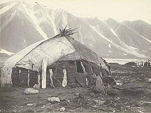
Plover Spit was once home to an old Eskimo village with unique semi-underground houses. Later, a more recent village of yarangas (traditional tents) was built there. US Coast Survey maps show a village called Rirak at the base of the spit. Starting in 1928, maps also showed a village named Uredlak on the south shore of Emma Harbor.
The Soviet-era village of Plover was likely on the mainland near the spit. It was damaged by a landslide, and its residents were moved to Provideniya. Nasskatulok, a Yupik village at the head of Plover Bay, was mentioned in 1881. There were also villages along the coast. Aiwan (Avan), a Yupik village, was east of the bay between the sea and a freshwater lake. Another village, Akatlak, was just west of the bay's mouth.
History of Providence Bay
Providence Bay and Emma Harbor did not appear on maps before 1850. It is believed that whalers visited them between 1845 and 1848, just before the Plover arrived. Russian explorer Kurbat Ivanov might have visited Providence Bay in 1660. However, his explorations were not widely known.
In September 1865, the ship Golden Gate, part of the Russian–American Telegraph Expedition, visited Plover Bay. A member of this expedition, Frederick Whymper, reported that by then, it was common to see several whaling ships in the bay during summer. Whymper described the mountains around Plover Bay as being broken up by frost. He noted that only lichens and mosses grew there, except for a green area near Emma Harbor where domesticated reindeer grazed.
Whaling and Trade
The area around Providence Bay was excellent for whaling, especially in the fall. This made it a popular place to spend the winter. In 1860, a court case in Hawaii involved the whaling ship Wailua. It had spent the winter in Plover Bay in 1858-1859 after staying too late in the fall. The crew claimed the captain had planned to stay the winter, causing them hardship. The court sided with the crew.
In 1866, Whymper saw whales being hunted and processed within the bay. In 1871, the whaling ship Oriole was damaged by ice. It was brought into Plover Bay for repairs but later sank there. By 1880, a visitor found the village on the spit much smaller. Whales were no longer plentiful, and many residents had moved away to find better hunting.
In 1875, the Russian ship Gaydamak anchored in Providence Bay. Its captain, Sergey Tyrtov, was ordered to control coastal trading. He gave out leaflets to foreign merchants. He then went north and stopped an American merchant boat that was trading walrus ivory for goods.
In 1876, Captain Novosilsky continued this mission on the ship Vsadnik. The Vsadnik anchored in Plover Bay on July 5, 1876. It surveyed the area and then sailed north, past the Bering Strait, reaching Cape Shmidt. The ship returned safely to its base. The Vsadnik did not find any merchant boats but saw signs of recent trading with America in local huts.
In 1881, the Russian ship Strelok anchored in Providence Bay. Besides surveying and border control, the Strelok was supposed to rescue crews from two missing American whaling ships. However, they learned one ship had sunk, and the other crew was already safe. Instead, the Strelok found and resupplied a German scientific expedition led by Aurel Krause.
Later that year, the U.S. revenue cutter Corwin also took on coal at Plover Bay. This was Russian government coal piled on the bank. John Muir, a naturalist on the Corwin, used these stops to study the geology of the mountains east of the fjord.
Trading Posts and Administration
An article from 1879 mentioned a "white men's trading station at Plover Bay." It is unclear if this was a permanent post or just a meeting spot. As late as 1880, only a native village was mentioned by a visitor. The Northeastern Siberian Company had a trading station called Vladimir on Plover Bay from at least 1903 until about 1910.
By 1913, Emma Harbor was home to Baron Kleist, a Russian administrator, a district judge, and an Estonian trader named Bally Thompson, who ran a store. Baron Kleist's house was built around 1909 using materials brought from Vladivostok.
In 1926, Yupik people from Provideniya Bay were asked to move to Wrangel Island. In 1930, Provideniya Bay was a temporary base for Soviet aircraft. These planes helped evacuate passengers from a Soviet ship that was stuck in ice off Mys Schmitda. The passengers spent the winter at Provideniya Bay and were picked up the following July.
Scientific Visits
Emma Harbor and Providence Bay were popular places for scientists to visit. These included observers from the US Naval Observatory who tried to watch a solar eclipse in 1869. Many scientists, including bird collectors, geologists, and the U.S. Coast and Geodetic Survey, also visited.
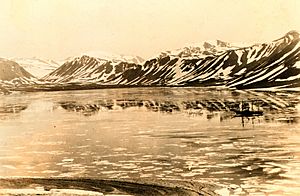
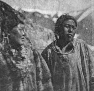
The Harriman Alaska Expedition visited in July 1899. They took many good photographs showing the land and the lives of the local people. John Muir noted that by 1899, about fifty Chukchis lived in a dozen huts covered with walrus hide. He felt they were already "spoiled by the contact with civilization of the whaler seamen." John Burroughs observed that "they were not shy of our cameras and freely admitted us to the greasy and smoky interiors of their dwellings."
Modern Importance
In 1921, there were reports of Japan trying to control the area. The bay's important location was noted by an American writer. Two Soviet-era towns, Provideniya and Ureliki, were built on Komsomolskaya Bay in the 20th century. The bay was used as a naval harbor. It became a major supply point for the Chukotka region during World War II.
After the Soviet Union broke up, five border patrol boats in Provideniya stayed unused in the port for three years because there was no fuel. Ureliki, which was a military town, is now reportedly empty. However, the nearby Provideniya Bay Airport is still in use.
 | Aurelia Browder |
 | Nannie Helen Burroughs |
 | Michelle Alexander |


