
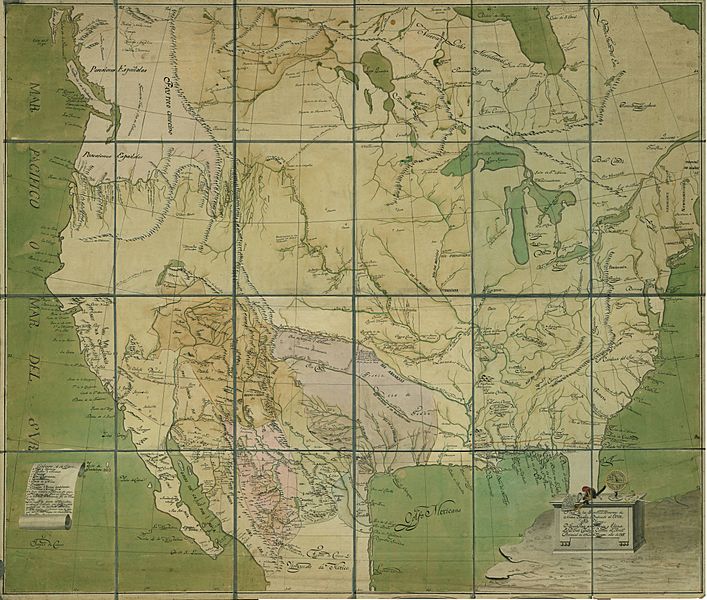
Image: Provincias Ynternas Nueva España 1817

Size of this preview: 707 × 600 pixels. Other resolutions: 283 × 240 pixels | 8,866 × 7,520 pixels.
Original image (8,866 × 7,520 pixels, file size: 8.11 MB, MIME type: image/jpeg)
Description: Map of the "internal provinces" of the viceroyalty of New Spain, 1817. Red lines represent Spanish expeditions and the yellow lines U.S. expeditions
Title: Provincias Ynternas Nueva España 1817
Credit: Real Academia de la Historia
Author: José Caballero, capitán de artillería provincial de Nueva Vizcaya
Usage Terms: Public domain
License: Public domain
Attribution Required?: No
Image usage
The following page links to this image:

All content from Kiddle encyclopedia articles (including the article images and facts) can be freely used under Attribution-ShareAlike license, unless stated otherwise.