
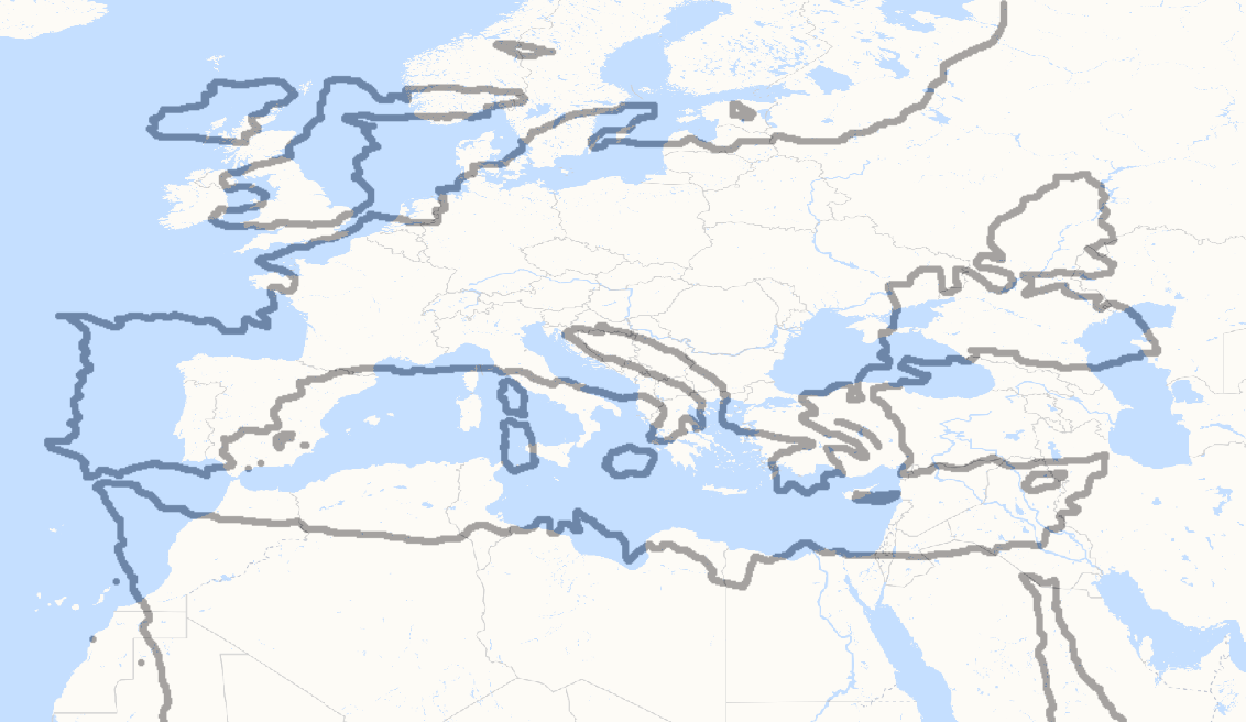
Image: Ptolemy map of Mediterranean superimposed on modern map
Size of this preview: 800 × 464 pixels. Other resolutions: 320 × 185 pixels | 1,132 × 656 pixels.
Original image (1,132 × 656 pixels, file size: 94 KB, MIME type: image/png)
Description: Ptolemy's map of the Mediterranean superimposed on a modern map. File:Bunbury Vol 2 Map 08 Ptolemy p 578.jpg was transformed to a rectangular projection in QGIS. The outline was traced, and then superimposed on a modern map on the same projection. The meridian of Greenwich was used as a reference for the alignment
Title: Ptolemy map of Mediterranean superimposed on modern map
Credit: Own work
Author: Kognos
Usage Terms: Creative Commons Attribution-Share Alike 4.0
License: CC BY-SA 4.0
License Link: https://creativecommons.org/licenses/by-sa/4.0
Attribution Required?: Yes
Image usage
The following page links to this image:

All content from Kiddle encyclopedia articles (including the article images and facts) can be freely used under Attribution-ShareAlike license, unless stated otherwise.