
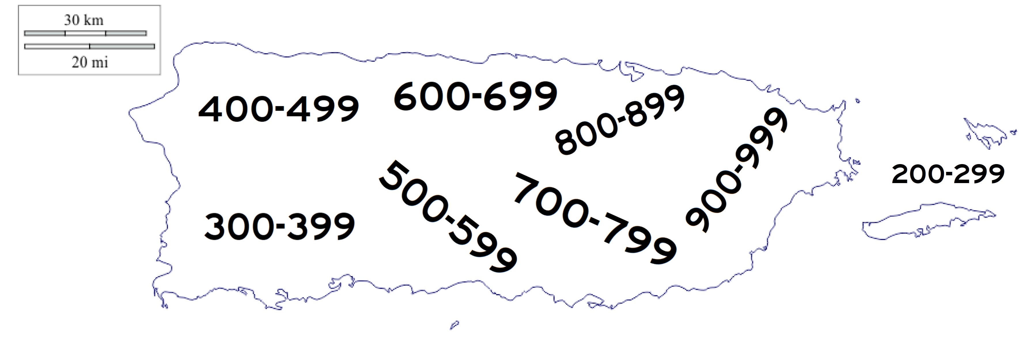
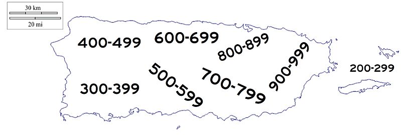
Image: PuertoRicoTertiaryRoadDiagram
Description: Puerto Rico has a comprehensive road system. This diagram only shows were the island's tertiary roads are located. Some roads may be found outside the regions marked but the majority fall where they're labelled. Even-numbered roads can be found on the northern half of the island. Odd-numbered roads can be found on the southern half. This is true only west of the capital city of San Juan. The 900s roads along with a few 700s roads cover the entire eastern section in its north and south.
Title: PuertoRicoTertiaryRoadDiagram
Credit: Own work
Author: Jackson1649
Usage Terms: Creative Commons Attribution-Share Alike 4.0
License: CC BY-SA 4.0
License Link: https://creativecommons.org/licenses/by-sa/4.0
Attribution Required?: Yes
Image usage
The following 2 pages link to this image:
