
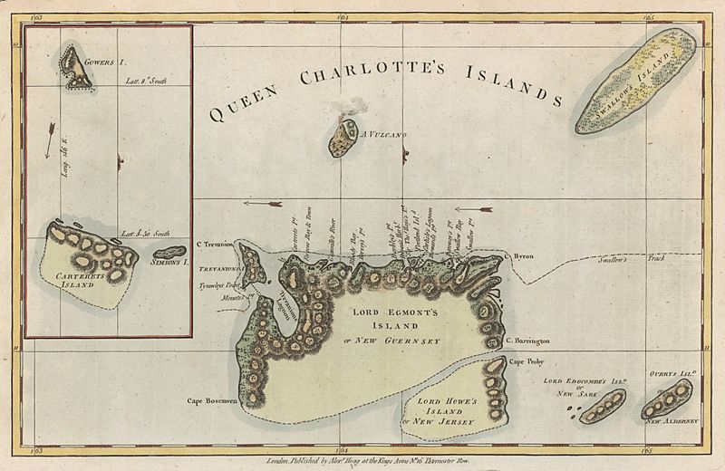
Image: Queen Charlotte's Islands map 1776

Size of this preview: 800 × 520 pixels. Other resolutions: 320 × 208 pixels | 4,149 × 2,696 pixels.
Original image (4,149 × 2,696 pixels, file size: 11.27 MB, MIME type: image/jpeg)
Description: Map of Queen Charlotte's Islands (Santa Cruz Islands) in the Solomon Islands. From George William Anderson’s A New, Authentic and Complete Collection of Voyages Around the World, Undertaken and Performed by Royal Authority . . . (London, 1784).
Title: Queen Charlotte's Islands map 1776
Credit: http://libweb5.princeton.edu/visual_materials/maps/websites/pacific/wallis-carteret/wallis-carteret.html
Author: Hogg, Alexander, fl. 1778–1819
Usage Terms: Public domain
License: Public domain
Attribution Required?: No
Image usage
The following page links to this image:

All content from Kiddle encyclopedia articles (including the article images and facts) can be freely used under Attribution-ShareAlike license, unless stated otherwise.