
Image: RamblesMap
No higher resolution available.
RamblesMap.png (597 × 538 pixels, file size: 58 KB, MIME type: image/png)
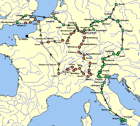
Description: Map of Mary Shelley and her son Percy Florence Shelley's travels in 1840 and 1842–1843, taken from The Novels and Selected Works of Mary Shelley. Vol. 8. Ed. Jeanne Moskal. London: William Pickering, 1996, pg. 58–59. The red dots and dotted line indicate the 1840 trip; the green dots and solid line indicate the 1842–43 trip; dual-colored dots indicate places visited on both trips; black dots indicate places not visited but helpful for the reader.
Author: Awadewit
Usage Terms: Creative Commons Attribution-Share Alike 3.0
License: CC-BY-SA-3.0
License Link: http://creativecommons.org/licenses/by-sa/3.0/
Attribution Required?: Yes
Image usage
The following page links to this image:

All content from Kiddle encyclopedia articles (including the article images and facts) can be freely used under Attribution-ShareAlike license, unless stated otherwise.