
Image: Rancho El Escorpion Hall Map 1880
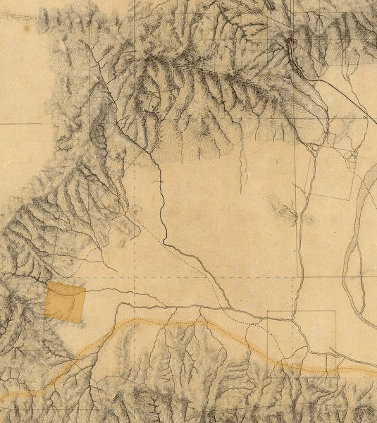
Description: Detail of the San Fernando Valley, from a manuscript map of Los Angeles and San Bernardino topography, 1880, by William Hammond Hall, Office of the State Engineer, California. The map shows Rancho El Escorpión (shaded, left in the foothills), Rancho El Encino or Rancho Los Encinos (lower right), Mission San Fernando Rey de España (upper right). The shaded dotted line is the Spanish El Camino Real. Rancho El Escorpión was formerly in Canoga Park (1913-1980s), and currently is in West Hills.
Title: Rancho El Escorpion Hall Map 1880
Credit: David Rumsey Map Collection
Author: William Hammond Hall (shading added by PKM)
Usage Terms: Public domain
License: Public domain
Attribution Required?: No
Image usage
The following 3 pages link to this image:
