
Image: RegioniIrredenteItalia
Size of this preview: 460 × 600 pixels. Other resolutions: 184 × 240 pixels | 632 × 824 pixels.
Original image (632 × 824 pixels, file size: 119 KB, MIME type: image/jpeg)
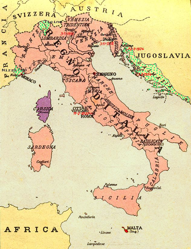
Description: Map of Kingdom of Italy (1919) showing the areas claimed by Irredentism:in red Malta, in purple Corsica, in yellow with green points Dalmatia, Ticino and Nizzardo. I have used as a basic map an old map from an Italian geography and history school book of 1935 "Scuole Medie Inferiori", and I have written and painted on it. Cropped caption: L’ Italia dopo la Guerra 1915-1918
Title: RegioniIrredenteItalia
Credit: Own work
Author: Brunodambrosio
Usage Terms: Public domain
License: Public domain
Attribution Required?: No
Image usage
The following 2 pages link to this image:

All content from Kiddle encyclopedia articles (including the article images and facts) can be freely used under Attribution-ShareAlike license, unless stated otherwise.