
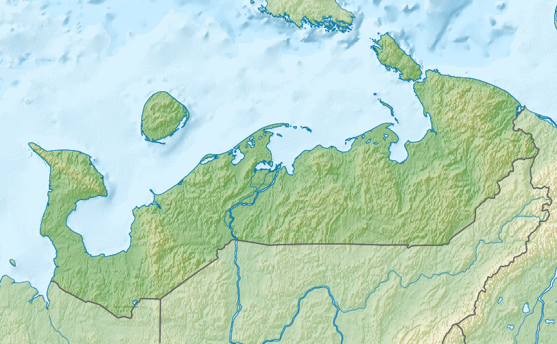
Image: Relief Map of Nenets Autonomous Okrug
Size of this preview: 800 × 495 pixels. Other resolutions: 320 × 198 pixels | 812 × 502 pixels.
Original image (812 × 502 pixels, file size: 450 KB, MIME type: image/png)
Description: Физическая карта Ненецкой автономной области (Россия). Координаты для GMT: -R42.0/66.5/65.4/71.0 Инструменты: GMT, Inkscape
Title: Relief Map of Nenets Autonomous Okrug
Credit: ETOPO1 database for relief data Natural Earth for regions boundaries Own work This PNG graphic was created with Inkscape.
Author: Nzeemin
Usage Terms: Creative Commons Attribution-Share Alike 3.0
License: CC BY-SA 3.0
License Link: https://creativecommons.org/licenses/by-sa/3.0
Attribution Required?: Yes
Image usage
The following page links to this image:

All content from Kiddle encyclopedia articles (including the article images and facts) can be freely used under Attribution-ShareAlike license, unless stated otherwise.