
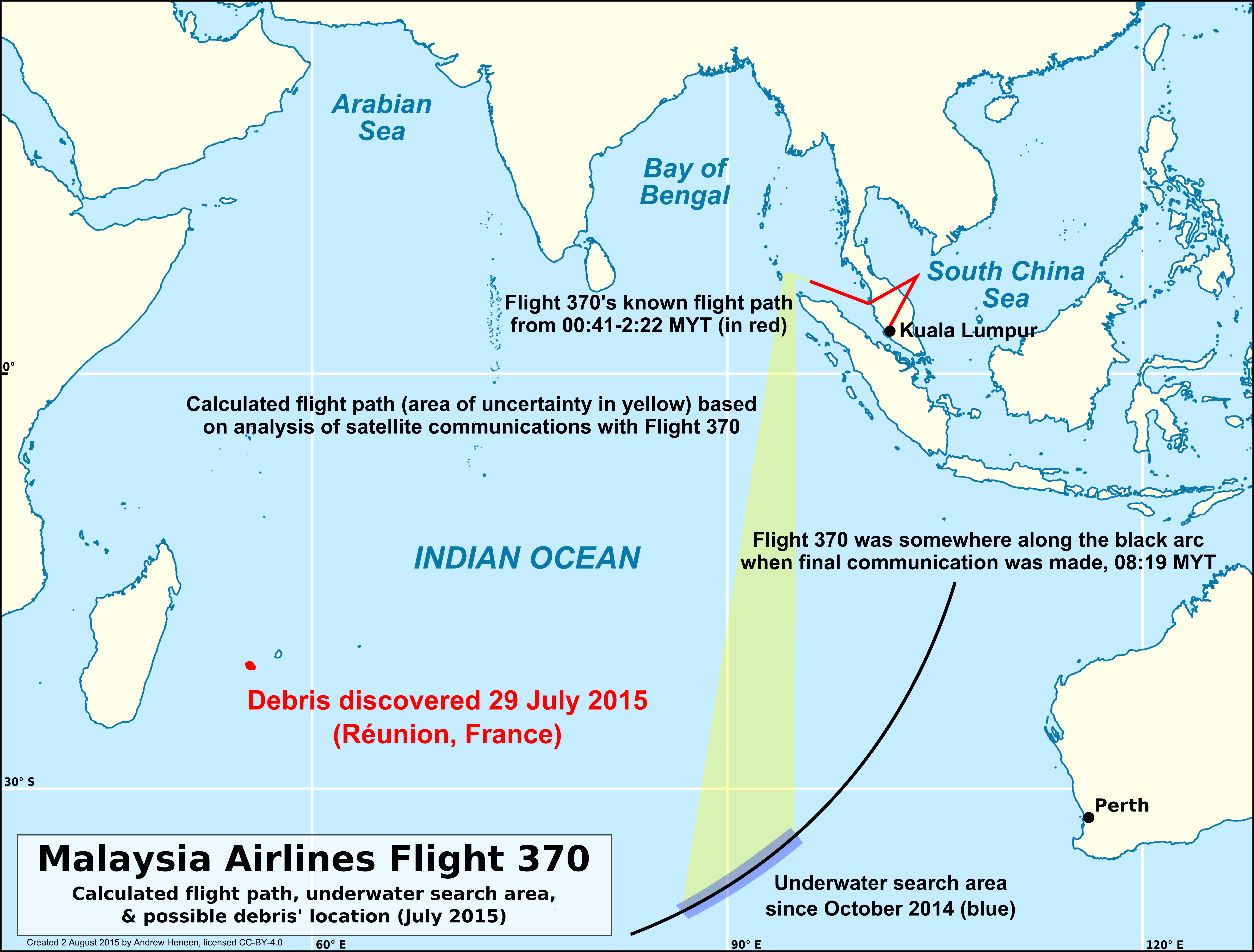
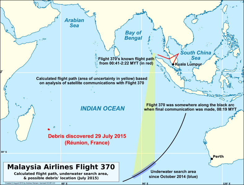
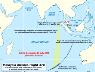
Image: Reunion debris compared to MH370 flight paths and underwater search area
Description: This map displays the location of Reunion Island, because of the debris part found there in 2015-07, in relation to the known flight path of Malaysia Airlines Flight 370 (shown in red; based on civilian & military radar), calculated flight path (shown in yellow; based on analysis of communications between Flight 370 and the Inmarsat satellite communications network), and the underwater search area at the time the debris was found (shown in dark blue; 46% searched at the time debris was found). The 08:19 MYT (00:19 UTC) BTO arc is the arc along which Flight 370 was located when its final communication was received. (Note: At the time of upload, officials have not confirmed the debris to be from Flight 370. However, all evidence points to the debris being the right wing flaperon of a Boeing 777 and Flight 370 is almost certainly the origin.)
Title: Reunion debris compared to MH370 flight paths and underwater search area
Credit: Own work Background created with public domain data from NaturalEarth
Author: Andrew Heneen
Permission: I, the copyright holder of this work, hereby publish it under the following license: This file is licensed under the Creative Commons Attribution 4.0 International license. You are free: to share – to copy, distribute and transmit the work to remix – to adapt the work Under the following conditions: attribution – You must attribute the work in the manner specified by the author or licensor (but not in any way that suggests that they endorse you or your use of the work). http://creativecommons.org/licenses/by/4.0 CC BY 4.0 Creative Commons Attribution 4.0 truetrue
Usage Terms: Creative Commons Attribution 4.0
License: CC BY 4.0
License Link: http://creativecommons.org/licenses/by/4.0
Attribution Required?: Yes
Image usage
The following page links to this image:
