
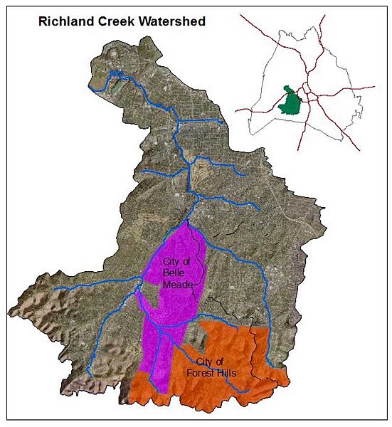
Image: Richland Creek, Nashville, Tennessee Watershed showing cities Belle Meade and Forest Hills

Description: This is a map from Page 1 of a report mandated by the US Government in the "1966 Safe Drinking Water Act" to the State of Tennessee (and all states). It requires the Metropolitan Government of Nashville and Davidson County to generate a report on Source Water Assessment. The image, taken from this report, is used on the Wikipedia article Richland Creek (Nashville, Tennessee). A link to the source where the image appears is given below.
Title: Richland Creek, Nashville, Tennessee Watershed showing cities Belle Meade and Forest Hills
Credit: Metro Water Services Stormwater Division
Author: Prepared by Metro Water Services Stormwater Division, Nashville, Tennessee
Usage Terms: Public domain
License: PD
Attribution Required?: No
Image usage
The following page links to this image:
