
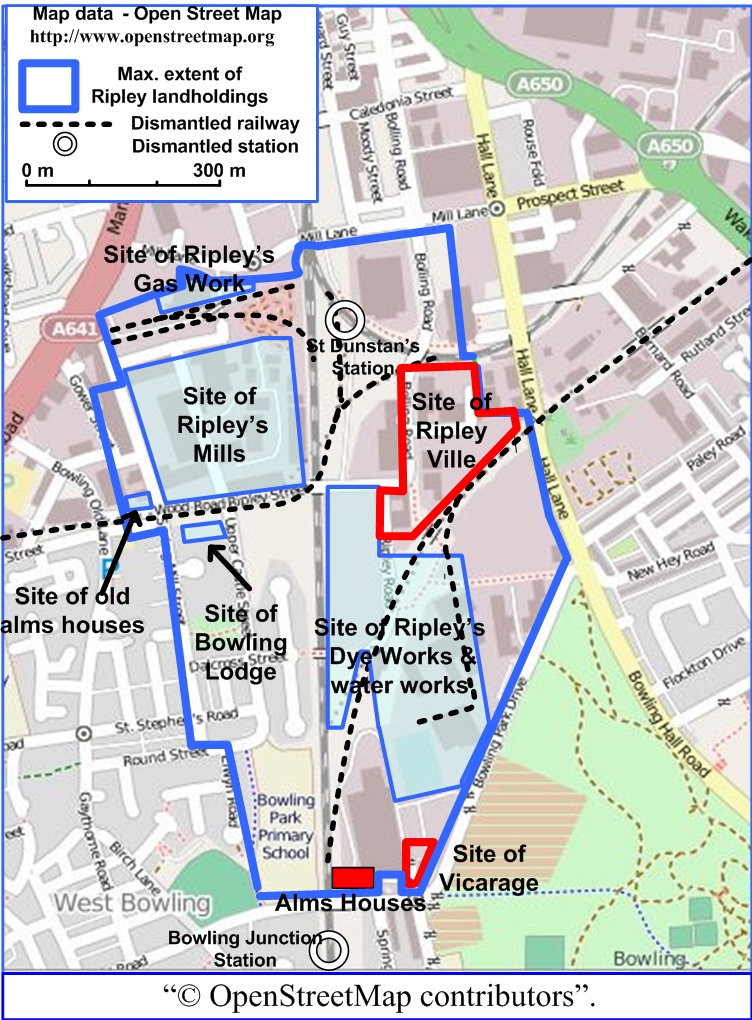
Image: Ripley Ville Locations on Open Street Map
Size of this preview: 442 × 600 pixels. Other resolutions: 177 × 240 pixels | 752 × 1,020 pixels.
Original image (752 × 1,020 pixels, file size: 567 KB, MIME type: image/jpeg)
Description: Ripley Ville and other demolished Ripley sites overdrawn on a 2014 Open Street Map of the relevant area of south Bradford
Title: Ripley Ville Locations on Open Street Map
Credit: http://www.openstreetmap.org
Author: Open Street Map
Permission: http://www.openstreetmap.org/copyright
Usage Terms: Creative Commons Attribution-Share Alike 1.0
License: CC BY-SA 1.0
License Link: https://creativecommons.org/licenses/by-sa/1.0
Attribution Required?: Yes
Image usage
The following page links to this image:

All content from Kiddle encyclopedia articles (including the article images and facts) can be freely used under Attribution-ShareAlike license, unless stated otherwise.