
Image: Road junction at Molls Gap - geograph.org.uk - 1218078
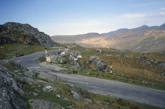
Description: Road junction at Molls Gap. Looking north-west along the road to Sneem with Macgillycuddy's Reeks on the right. The road leading off to the right is for Killarney and the left turn is for Kenmare. There are a few places to park here to take in the views. Looks like the signs have been changed since this 1992 shot (see 495243), probably to accommodate distances shown in kilometres now that Eire is fully metric. I seem to remember in 1992 that there was a hybrid situation with some road signs in miles and others in kilometres, often without the units shown - very confusing!
Title: Road junction at Molls Gap - geograph.org.uk - 1218078
Credit: From geograph.org.uk
Author: Trevor Rickard
Usage Terms: Creative Commons Attribution-Share Alike 2.0
License: CC BY-SA 2.0
License Link: https://creativecommons.org/licenses/by-sa/2.0
Attribution Required?: Yes
Image usage
The following page links to this image:
