
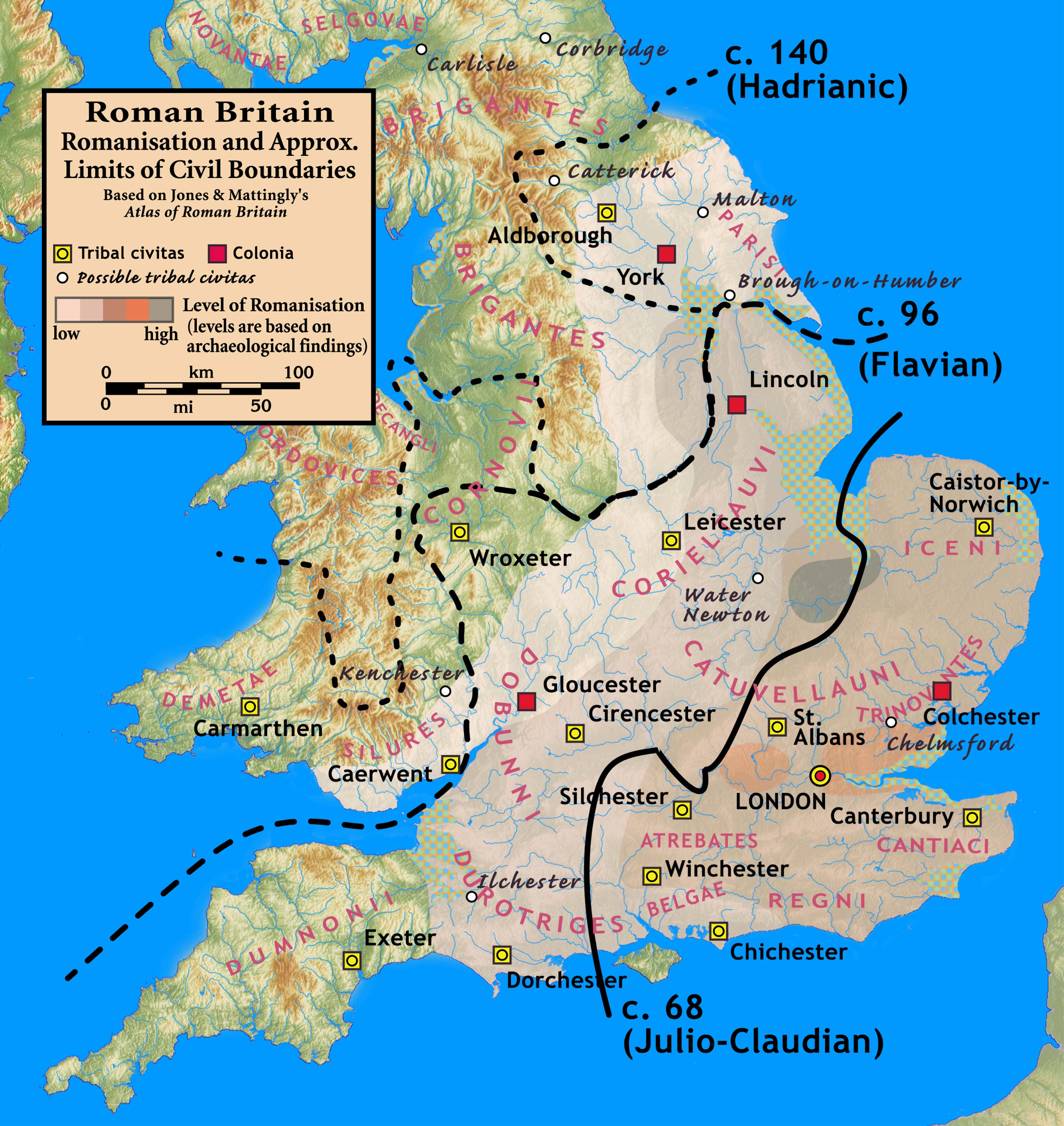
Image: Roman.Britain.Romanisation
Description: Roman Britain — Levels of Romanisation and Approximate Limits of Civil Boundaries
Title: Roman.Britain.Romanisation
Credit: Based on Jones & Mattingly's Atlas of Roman Britain (ISBN 978-1-84217-06700, 1990, reprinted 2007) — the source is cited in the image legend — Approximate civil boundaries, civitates, and coloniae are given on page 154. Levels of Romanisation ("boundaries of acculturation" with levels from "high density" to "low density" in the text) are given on page 151, with the authors citing it as a computer-generated map based on data contained in the standard Ordnance Survey map of Roman Britain. The topographical map is from a sub-region of File:Uk topo en.jpg, with the copyright notice Template:Bild-GFDL-GMT and original date of 7 July 2006, copy made in 2008, with the annotations removed by myself.
Author: my work
Permission: (see below)
Usage Terms: Creative Commons Attribution-Share Alike 3.0
License: CC BY-SA 3.0
License Link: http://creativecommons.org/licenses/by-sa/3.0
Attribution Required?: Yes
Image usage
The following 5 pages link to this image:
