
Image: Roman province of Dacia (106 - 271 AD)

Size of this PNG preview of this SVG file: 692 × 600 pixels. Other resolution: 277 × 240 pixels.
Original image (SVG file, nominally 1,500 × 1,300 pixels, file size: 392 KB)
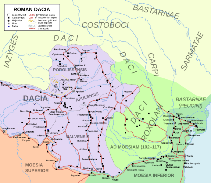
Description: Roman province of Dacia, part of modern day Romania and Serbia, from the conquest of Trajan in 106 AD to the evacuation of the province in 271 AD. Roman settlements and legion garrisons with Latin names are included in the map, as well as the Costoboci, Carpi and Free Dacians.
Title: Roman province of Dacia (106 - 271 AD)
Credit: Own work, based on similar historical map made by the Romanian Academy (which ones?)
Author: User:Andrei nacu, uploaded at Commons by El_Bes
Usage Terms: Creative Commons Attribution-Share Alike 3.0 ro
License: CC BY-SA 3.0 ro
License Link: https://creativecommons.org/licenses/by-sa/3.0/ro/deed.en
Attribution Required?: Yes
Image usage
The following 2 pages link to this image:

All content from Kiddle encyclopedia articles (including the article images and facts) can be freely used under Attribution-ShareAlike license, unless stated otherwise.
.svg)