
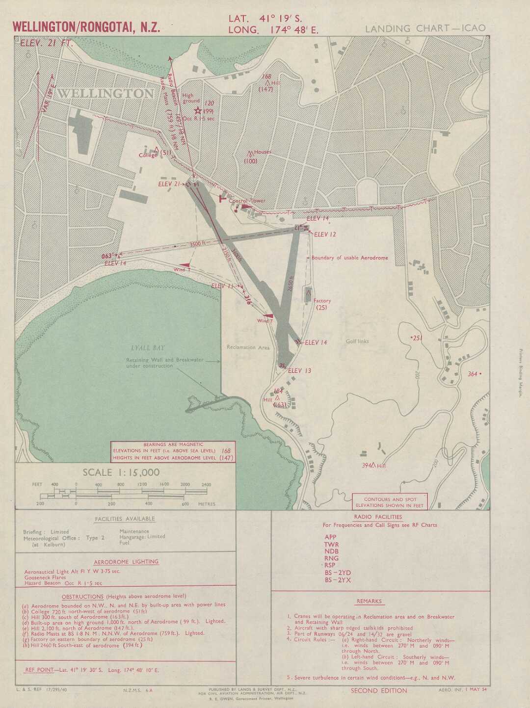
Image: Rongotai Aerodrome 1954 Landing chart
Size of this preview: 449 × 600 pixels. Other resolutions: 179 × 240 pixels | 1,080 × 1,443 pixels.
Original image (1,080 × 1,443 pixels, file size: 149 KB, MIME type: image/jpeg)
Description: By New Zealand. Department of Lands and Survey cartographer., New Zealand. Civil Aviation Administration. Series NZMS 6A. Archived by the National Library of New Zealand in TIFF. Relief shown by spot heights. "Aero. Inf. 1 May 54." Map scanned at resolution of 600 ppi. Electronic reproduction of part of Land Information New Zealand original. Wellington, N.Z. : University of Auckland, 2013. Mode of access: World Wide Web. Second edition Scale 1:15,000 (E 174°48ʹ10ʺ/S 41°19ʹ30ʺ). Publisher [Wellington] : Published by Lands & Survey Dept., N.Z., for Civil Aviation Administration, Air Dept, N.Z., 1954.
Format: 1 online resource colour
Usage Terms: Public domain
Image usage
The following page links to this image:

All content from Kiddle encyclopedia articles (including the article images and facts) can be freely used under Attribution-ShareAlike license, unless stated otherwise.