
Image: Ruhr area-map

Size of this preview: 800 × 474 pixels. Other resolutions: 320 × 190 pixels | 1,000 × 593 pixels.
Original image (1,000 × 593 pixels, file size: 86 KB, MIME type: image/png)
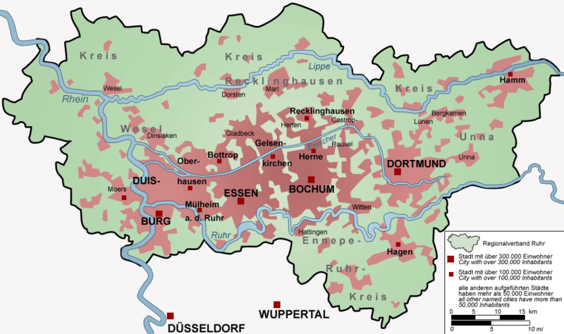
Description: Map of the Ruhr area, Germany – The map shows the Ruhr Area (Regionalverband Ruhr) with all cities with more than 50,000 inhabitants.
Title: Ruhr area-map
Credit: "drawn" by myself, Threedots (Daniel Ullrich), with Adobe Photoshop 6.0; used data set: official GeoData (former URL: www.ruhrgebiet.de/daten/geodatenserver.shtml) and several other maps
Author: Threedots (Daniel Ullrich)
Usage Terms: Creative Commons Attribution-Share Alike 3.0
License: CC-BY-SA-3.0
License Link: http://creativecommons.org/licenses/by-sa/3.0/
Attribution Required?: Yes
Image usage
The following 3 pages link to this image:

All content from Kiddle encyclopedia articles (including the article images and facts) can be freely used under Attribution-ShareAlike license, unless stated otherwise.