
Image: STS059-238-074 Strait of Gibraltar
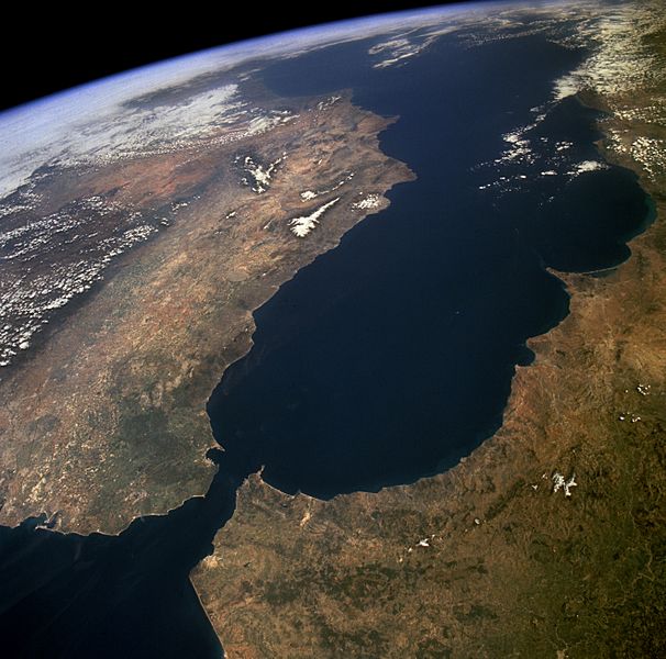
Description: The Strait of Gibraltar provides a natural physical barrier between the countries of Spain (north) and Morocco (south). In geologic terms, the 10-mile (16-kilometer) strait that separates the two countries, as well as Europe and Africa, is located where the two major tectonic plates—the Eurasian Plate and the African Plate—collide. This high-oblique, northeast-looking photograph shows the mountainous northern coast of Morocco and the coastal mountains of southern Spain, including the dagger-shaped, snow-covered Sierra Nevada Mountains of southeastern Spain. The Guadalquivir River flows from east to west along the base of the Sierra Morena Mountains in southern Spain. The famous British city of Gibraltar is located on the wedge-shaped peninsula on the east side of the bay in the southernmost protrusion of Spain. The city of Ceuta is a Spanish enclave on the extreme northeastern coast of Morocco. Ceuta, a free port with a large harbor, has remained under Spanish control since 1580.
Title: STS059-238-074 Strait of Gibraltar
Credit: http://images.jsc.nasa.gov/luceneweb/caption_direct.jsp?photoId=STS059-238-074 https://www.flickr.com/photos/nasa2explore/9364207155/
Author: NASA
Usage Terms: Public domain
License: Public domain
Attribution Required?: No
Image usage
The following 5 pages link to this image:
