
Image: Saharan topographic elements map

Size of this preview: 800 × 395 pixels. Other resolutions: 320 × 158 pixels | 1,396 × 690 pixels.
Original image (1,396 × 690 pixels, file size: 757 KB, MIME type: image/png)
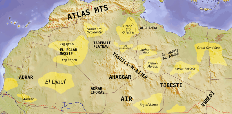
Description: Map showing major Dune seas (ergs) and Mountain ranges of the Sahara. Red dashed line shows approximate limit of the Sahara. National borders in grey. Dune seas in yellow. Derived from Blank map Image:Africa_topography_map_with_borders.png. Data taken from http://www.sahara-overland.com image of Michlein Map and Geology.com's Sahara Desert Map.
Title: Saharan topographic elements map
Credit: Own work by uploader Derived from Blank map Image:Africa_topography_map_with_borders.png
Author: T L Miles
Usage Terms: Creative Commons Attribution-Share Alike 3.0
License: CC BY-SA 3.0
License Link: http://creativecommons.org/licenses/by-sa/3.0
Attribution Required?: Yes
Image usage
The following 2 pages link to this image:

All content from Kiddle encyclopedia articles (including the article images and facts) can be freely used under Attribution-ShareAlike license, unless stated otherwise.