Image: Samos2022OSM

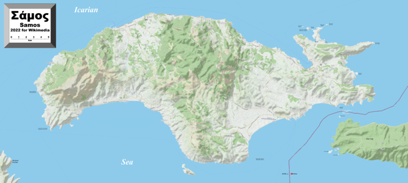
Description: This map of Samos shows the island's towns, villages, outlying islands and some other geographical details, and is likely the most comprehensive map of the island in this respect that you'll find anywhere online. It has been stitched together from panels of Open Street Map (which is freely licensed to all) with details plotted by the uploader. Insofar as was possible for somebody who does not speak Greek (but I do know the alphabet), all names on the map have been labelled in both Greek script (as all originally were on OSM ) and Latin script (some were in one or the other only). Please leave any notifications of mistakes on my English Wikipedia Talk page. They can be corrected easily — if you have a correction ready.
Title: Samos2022OSM
Credit: Own work
Author: Kelisi
Permission: The aforesaid website is freely usable to all.
Usage Terms: Creative Commons Attribution-Share Alike 4.0
License: CC BY-SA 4.0
License Link: https://creativecommons.org/licenses/by-sa/4.0
Attribution Required?: Yes
Image usage
The following page links to this image:

