
Image: SanJuanMountainsMap
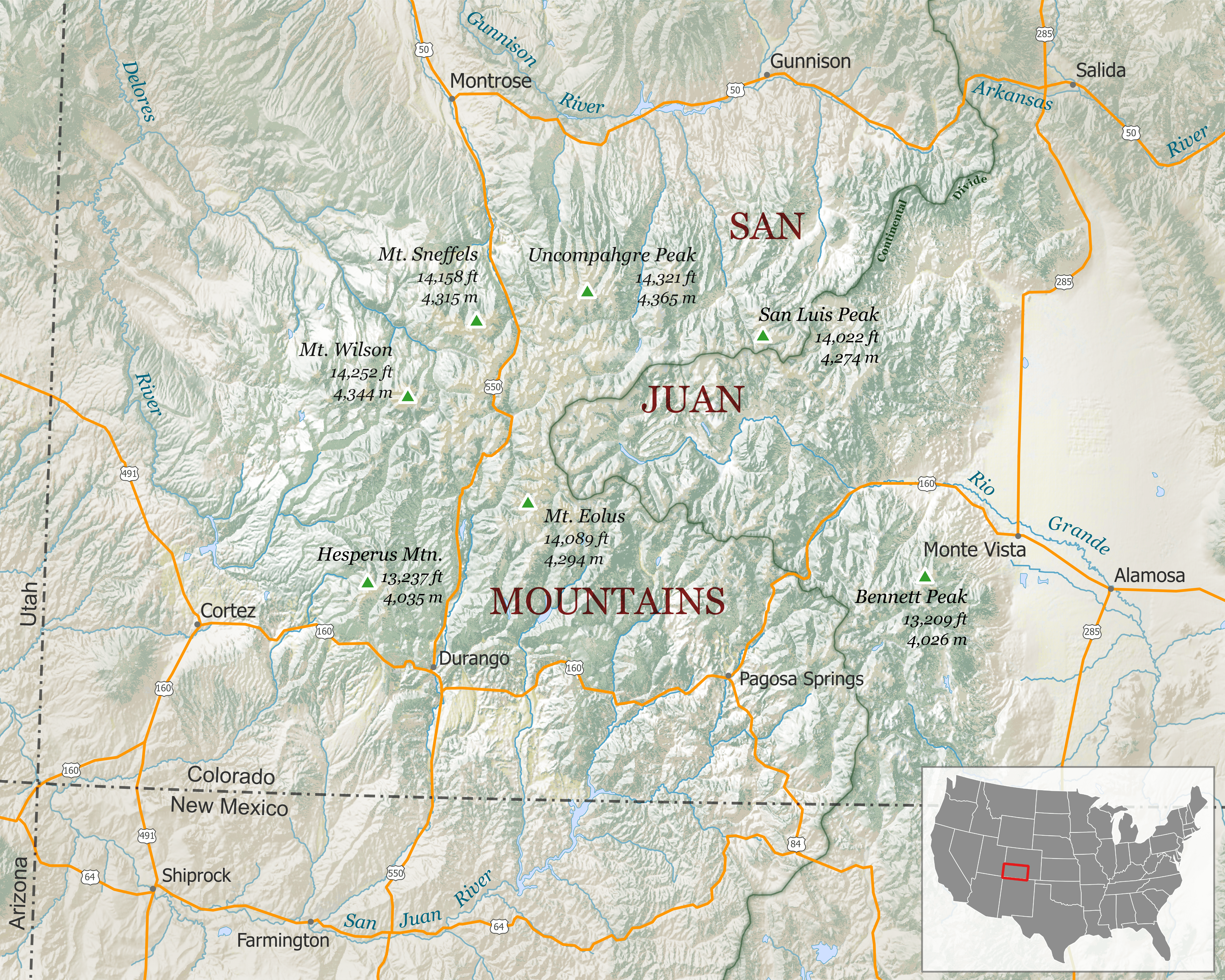
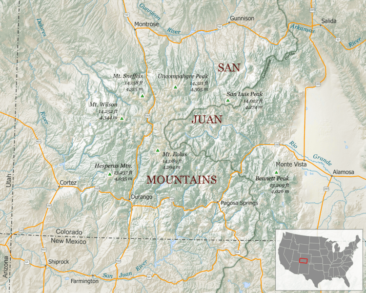
Description: Map of the San Juan Mountains are of southern Colorado. Includes major highways, rivers, towns and peaks. Shaded relief basemap is used to visualize the terrain. Scale - 1:1,200,000 Projection: North America Albers Data Sources: Land Cover, Highways, Shaded Relief, Cities/Towns; Hydrography – The National Map Small Scale Collection; Peaks – USGS GNIS; State Boundaries – Natural Earth data
Title: SanJuanMountainsMap
Credit: Own work
Author: Tanner Arrington
Permission: This file is licensed under the Creative Commons Attribution-Share Alike 4.0 International license. You are free: to share – to copy, distribute and transmit the work to remix – to adapt the work Under the following conditions: attribution – You must give appropriate credit, provide a link to the license, and indicate if changes were made. You may do so in any reasonable manner, but not in any way that suggests the licensor endorses you or your use. share alike – If you remix, transform, or build upon the material, you must distribute your contributions under the same or compatible license as the original. https://creativecommons.org/licenses/by-sa/4.0 CC BY-SA 4.0 Creative Commons Attribution-Share Alike 4.0 truetrue
Usage Terms: Creative Commons Attribution-Share Alike 4.0
License: CC BY-SA 4.0
License Link: https://creativecommons.org/licenses/by-sa/4.0
Attribution Required?: Yes
Image usage
The following page links to this image:
