
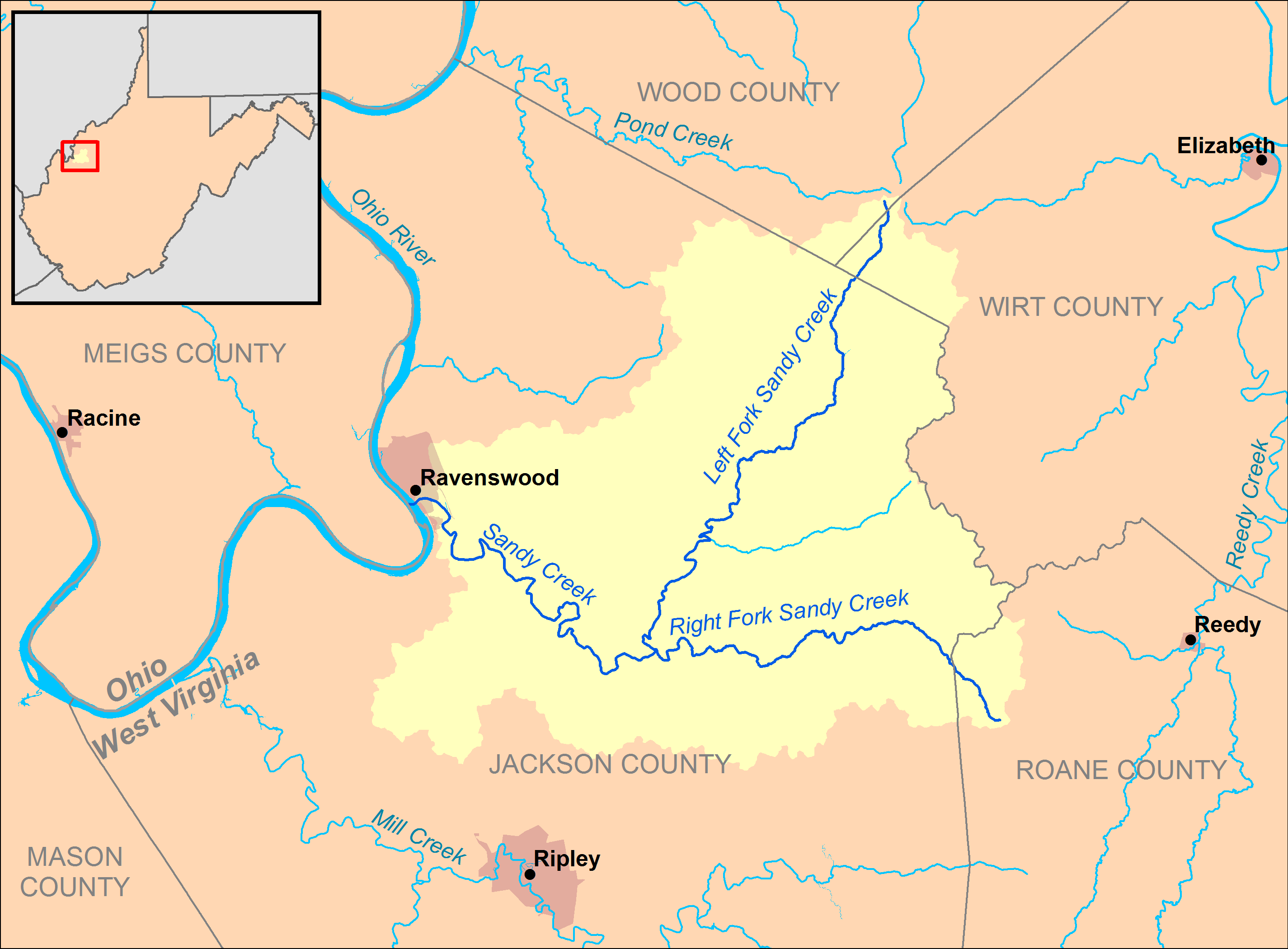
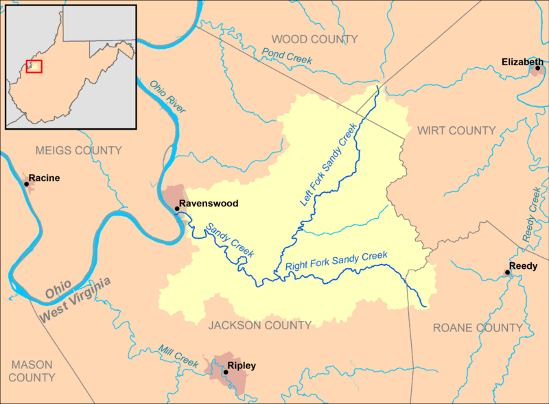
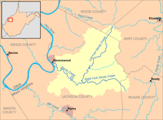
Image: Sandy Creek (Ohio River) map
Size of this preview: 800 × 589 pixels. Other resolutions: 320 × 236 pixels | 2,850 × 2,100 pixels.
Original image (2,850 × 2,100 pixels, file size: 227 KB, MIME type: image/png)
Description: A map of Sandy Creek and its watershed (USGS HUC-12 codes 050302020501, 050302020502, 050302020503, and 050302020504) in Jackson, Wood, Wirt, and Roane counties in West Virginia.
Title: Sandy Creek (Ohio River) map
Credit: Own work, data from w:The National Map
Author: Tim Kiser (User:Malepheasant)
Usage Terms: Creative Commons Attribution-Share Alike 3.0
License: CC BY-SA 3.0
License Link: https://creativecommons.org/licenses/by-sa/3.0
Attribution Required?: Yes
Image usage
The following page links to this image:

All content from Kiddle encyclopedia articles (including the article images and facts) can be freely used under Attribution-ShareAlike license, unless stated otherwise.
_map.png)