
Image: Santa maria river map

Size of this preview: 800 × 548 pixels. Other resolutions: 320 × 219 pixels | 2,560 × 1,755 pixels.
Original image (2,560 × 1,755 pixels, file size: 5.51 MB, MIME type: image/png)
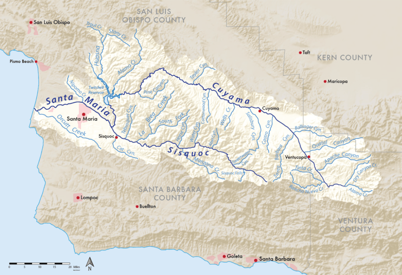
Description: Map showing the Santa Maria River watershed in Central California, with its main tributaries Cuyama River and Sisquoc River. Shaded relief and watershed boundary data from USGS National Map (public domain).
Title: Santa maria river map
Credit: Own work
Author: Shannon1
Usage Terms: Creative Commons Attribution-Share Alike 4.0
License: CC BY-SA 4.0
License Link: https://creativecommons.org/licenses/by-sa/4.0
Attribution Required?: Yes
Image usage
The following 4 pages link to this image:

All content from Kiddle encyclopedia articles (including the article images and facts) can be freely used under Attribution-ShareAlike license, unless stated otherwise.