
Image: Sargon II map
Size of this preview: 753 × 599 pixels. Other resolutions: 302 × 240 pixels | 2,077 × 1,653 pixels.
Original image (2,077 × 1,653 pixels, file size: 854 KB, MIME type: image/png)
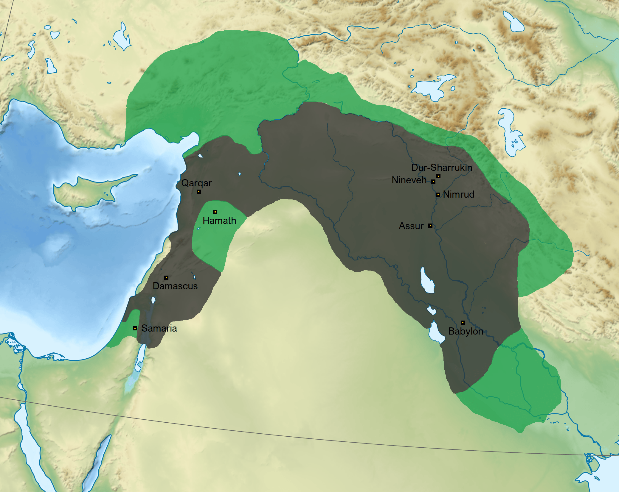
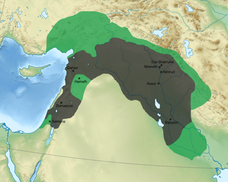
Description: Map of the Neo-Assyrian Empire in the reign of Sargon II. The darker parts are the imperial borders under Tiglath-Pileser III and the green parts show Sargon's conquests. Follows A Companion to Assyria (2017) p. 179.
Title: Sargon II map
Credit: Own work
Author: Ichthyovenator Sémhur (base map)
Usage Terms: Creative Commons Attribution-Share Alike 4.0
License: CC BY-SA 4.0
License Link: https://creativecommons.org/licenses/by-sa/4.0
Attribution Required?: Yes
Image usage
The following page links to this image:

All content from Kiddle encyclopedia articles (including the article images and facts) can be freely used under Attribution-ShareAlike license, unless stated otherwise.