
Image: SauvieIsland
Size of this preview: 594 × 600 pixels. Other resolutions: 238 × 240 pixels | 1,581 × 1,596 pixels.
Original image (1,581 × 1,596 pixels, file size: 105 KB, MIME type: image/png)
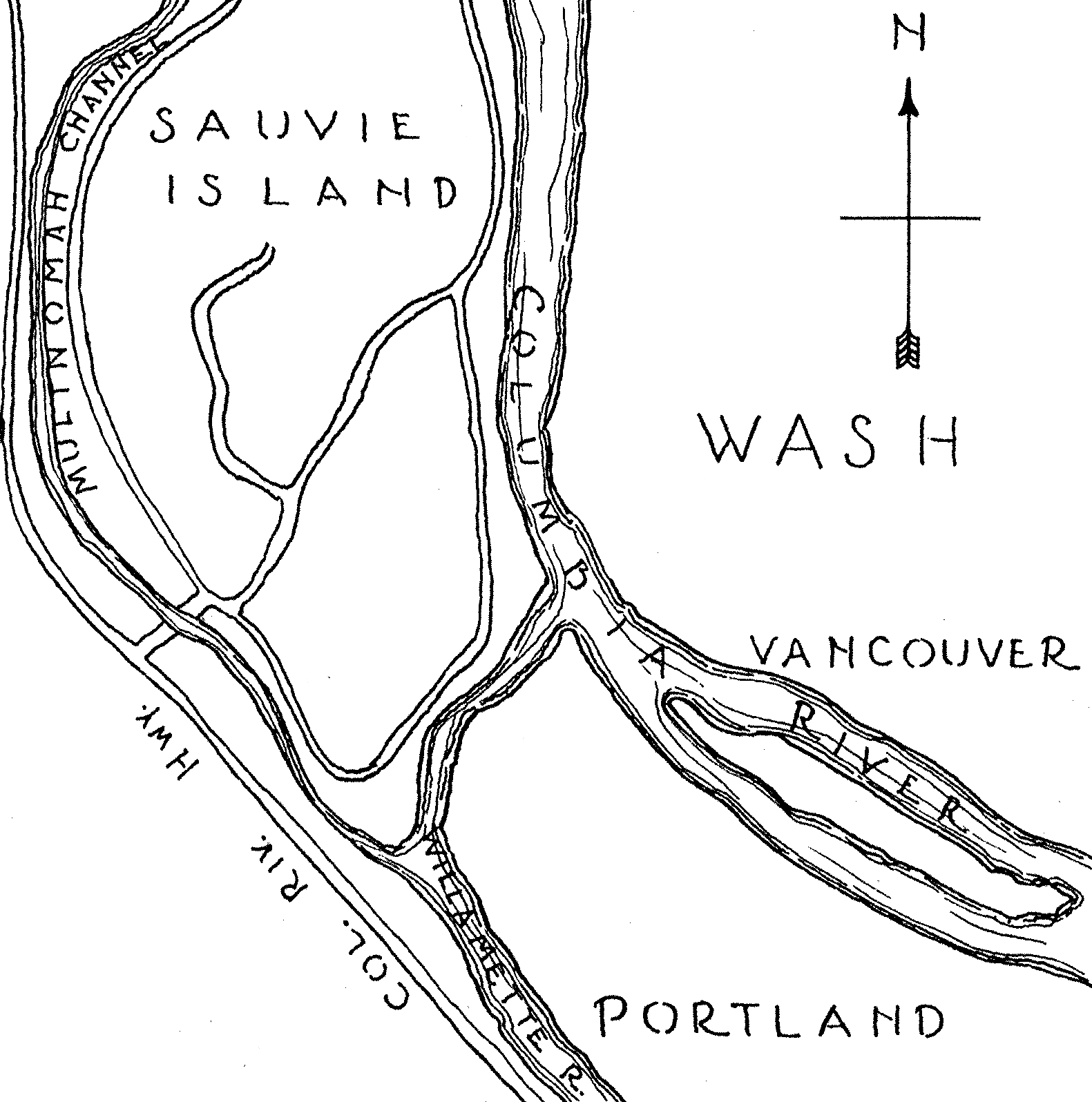
Description: Sketch map of en:Sauvie Island, Drawn June 30, 1937.
Title: SauvieIsland
Credit: cropped and touched up from an image taken at http://memory.loc.gov/cgi-bin/query/S?ammem/hh:@field(SUBJ+@od1(OREGON--Multnomah+County--Sauvie's+Island)) (Call number HABS, ORE,26-SAUVI,1-), from the en:National Park Service via the en:Library of Congress.
Author: HABS
Usage Terms: Public domain
License: Public domain
Attribution Required?: No
Image usage
The following page links to this image:

All content from Kiddle encyclopedia articles (including the article images and facts) can be freely used under Attribution-ShareAlike license, unless stated otherwise.