
Image: Savick Brook navigation weir; Ribble Link - geograph.org.uk - 949603
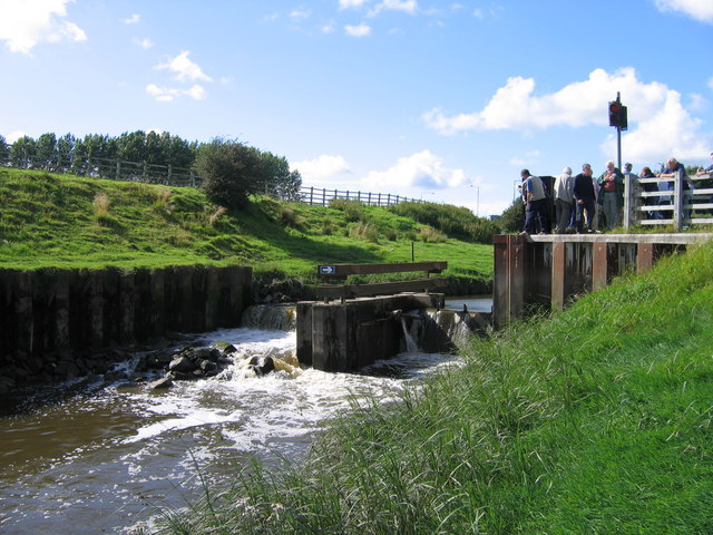
Description: Savick Brook navigation weir; Ribble Link, near to Lea Town, Lancashire, Great Britain. The lowest lock on the Ribble Link, opened in 2002 and using the Savick Brook to connect the Lancaster Canal with the River Ribble, is a navigation weir, seen here being examined by a party of industrial archaeologists. A horizontally-pivoted gate, to the right of the mid-channel concrete island, holds back sufficient water in the brook to keep boats afloat. When the incoming tide from the Ribble raises the water in the brook below the weir to the same level, the gate is lowered and boats may pass to and fro. The conventional weir to the left of the island allows surplus water in the brook to drain away during times of heavy rain.
Title: Savick Brook navigation weir; Ribble Link - geograph.org.uk - 949603
Credit: From geograph.org.uk; transferred by User:Skinsmoke using geograph_org2commons.
Author: A-M-Jervis
Permission: Creative Commons Attribution Share-alike license 2.0
Usage Terms: Creative Commons Attribution-Share Alike 2.0
License: CC BY-SA 2.0
License Link: https://creativecommons.org/licenses/by-sa/2.0
Attribution Required?: Yes
Image usage
The following page links to this image:
