
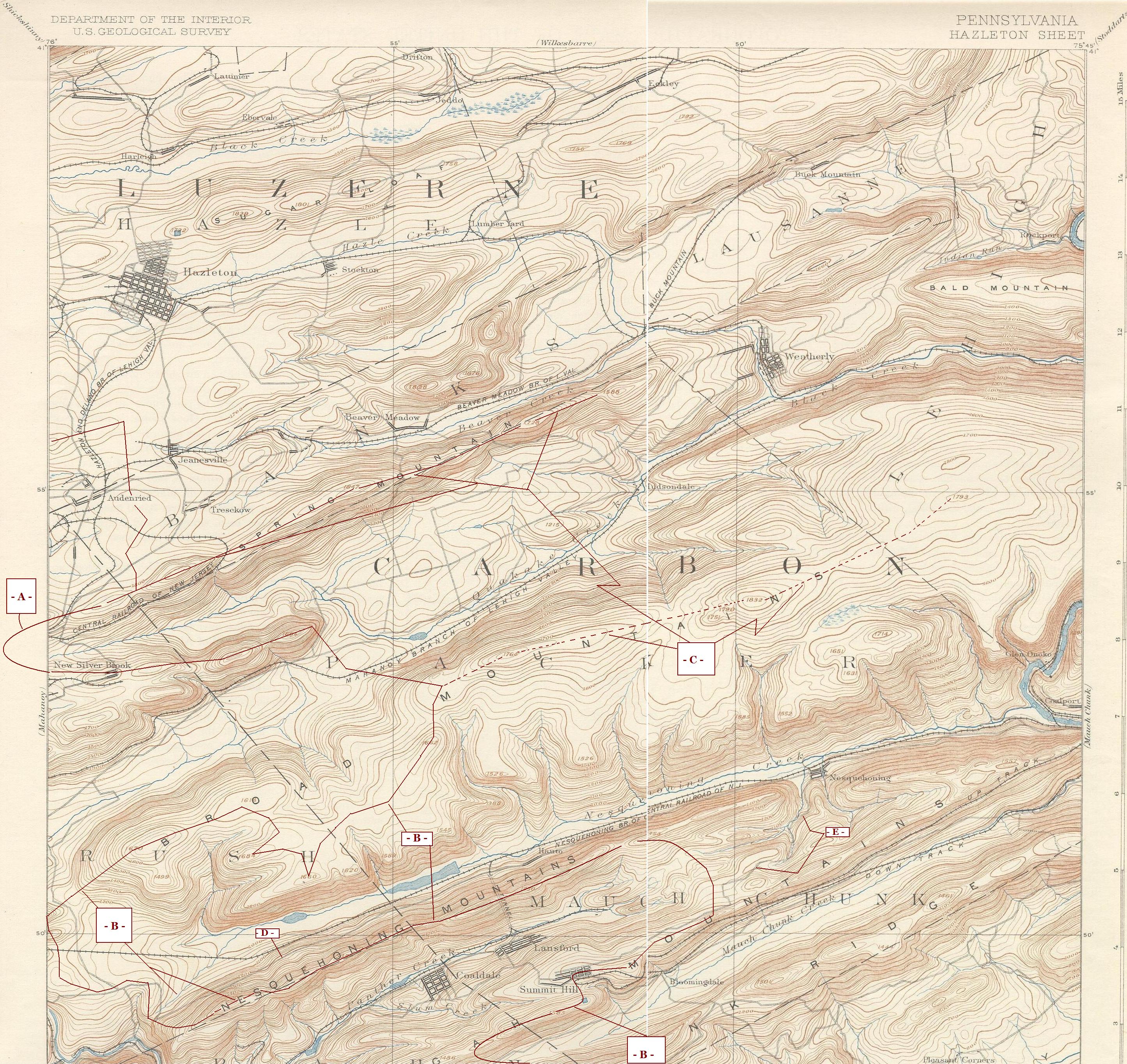
Image: Schuylkill-Lehigh River Drainage Divides USGS, Hazelton-Mauch Chunk &Mountain Quads,NW+NE-4
Description: This is a sufficiently detailed derivative work of two 19th Century USGS maps as reprinted in the 1930s with annotations showing Watersheds (by any cultural definition). • The map is centered on the three parallel ridges that run SW-to-NE but pinch down and converge into a steep valley along the Lehigh Valley in the stretch (N+W-to-S+E) Nesquehoning, Jim Thorpe (formerly Mauch Chunk, and Lehighton in the middle Lehigh Valley. • That is showing several topological Geological features, mainly Major and Minor Drainage Divides and parts of Drainage Basins.
Title: Schuylkill-Lehigh River Drainage Divides USGS, Hazelton-Mauch Chunk &Mountain Quads,NW+NE-4
Credit: USGS Hazelton Pennsylvania Quadrants merged and annotated
Author: Fabartus
Usage Terms: Public domain
License: Public domain
Attribution Required?: No
Image usage
The following image is a duplicate of this image (more details):
The following page links to this image:
